
IMAGES TAKEN NEAR TO
Slag Lane, WESTBURY, BA13 4GE
Introduction
This page details the photographs taken nearby to Slag Lane, BA13 4GE by members of the Geograph project.
The Geograph project started in 2005 with the aim of publishing, organising and preserving representative images for every square kilometre of Great Britain, Ireland and the Isle of Man.

There are currently over 7.5m images from over14,400 individuals and you can help contribute to the project by visiting https://www.geograph.org.uk
Image Map
Images are licensed for reuse under creativecommons.org/licenses/by-sa/2.0
Notes
- Clicking on the map will re-center to the selected point.
- The higher the marker number, the further away the image location is from the centre of the postcode.
Image Listing (67 Images Found)
Images are licensed for reuse under creativecommons.org/licenses/by-sa/2.0
Image
Details
Distance
1
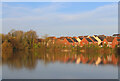
Lake in Wesbury
View across the lake towards Slag Lane.
Image: © Wayland Smith
Taken: 30 Mar 2021
0.02 miles
4
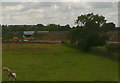
View towards Slag Lane
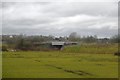
The train I am on has not stopped at Westbury so has taken the avoiding line to the south. The line through the station rejoins us here, crossing Slag Lane as it does so, by the yellow machinery.
This photo was taken from the 1158 Penzance to London Paddington train, having left Castle Cary at 1550.
Image: © Graham Horn
Taken: 9 Jul 2011
0.09 miles
5
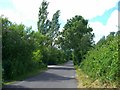
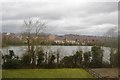
Frogmore Road, Westbury
A North-west view of part of Frogmore Road, Westbury. A large lake is to our left which is a disused mine hole. To the left part way up the road and visible in the picture is a platform on which to park cars and fish from. However, persistant littering has produced the inevitable result of it now being fenced off and made unusable.
Image: © Philip Reed
Taken: 22 Jun 2008
0.09 miles
6
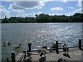
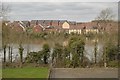
Frogmore Road lake, Westbury
A view looking South south-west across one of the two lakes around Frogmore Road, Westbury. Originally these were 'mine pits' belonging to the now long demolished iron works. Indeed some residents of Westbury refer to the lakes as the 'mine holes.'
Image: © Philip Reed
Taken: 22 Jun 2008
0.10 miles
8
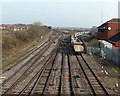
Westbury North Junction
Viewed from Station Road bridge. Left for Bristol and Chippenham via Trowbridge.
Right for London via Pewsey. Westbury railway station http://www.geograph.org.uk/photo/3896050 is on the opposite side of the bridge.
Image: © Jaggery
Taken: 8 Mar 2014
0.11 miles

10
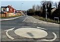
Slag Lane, Westbury
Viewed across a Station Road mini-roundabout looking towards recently-built houses in Lakeside View.
Image: © Jaggery
Taken: 8 Mar 2014
0.11 miles