
IMAGES TAKEN NEAR TO
Cossington Square, WESTBURY, BA13 4GA
Introduction
This page details the photographs taken nearby to Cossington Square, BA13 4GA by members of the Geograph project.
The Geograph project started in 2005 with the aim of publishing, organising and preserving representative images for every square kilometre of Great Britain, Ireland and the Isle of Man.

There are currently over 7.5m images from over14,400 individuals and you can help contribute to the project by visiting https://www.geograph.org.uk
Image Map
Images are licensed for reuse under creativecommons.org/licenses/by-sa/2.0
Notes
- Clicking on the map will re-center to the selected point.
- The higher the marker number, the further away the image location is from the centre of the postcode.
Image Listing (148 Images Found)
Images are licensed for reuse under creativecommons.org/licenses/by-sa/2.0
Image
Details
Distance
1
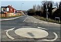
Slag Lane, Westbury
Viewed across a Station Road mini-roundabout looking towards recently-built houses in Lakeside View.
Image: © Jaggery
Taken: 8 Mar 2014
0.03 miles
2
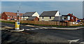
Lakeside View, Westbury
Recently-built houses viewed across the junction of Station Road and Slag Lane.
Image: © Jaggery
Taken: 8 Mar 2014
0.04 miles
3
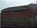
Westbury : Brick Building
This is Westbury Power Signal Box, built by British Railways and opened in May 1984. It replaced a number of mechanical signal boxes, and will itself become redundant sometime in the 2020s decade when its duties are taken over by a new Railway Operating Centre at Didcot.
Image: © Lewis Clarke
Taken: 27 May 2009
0.04 miles
5
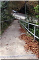
Path from Station Road to Station Approach, Westbury
Turn right ahead for Westbury railway station. https://www.geograph.org.uk/photo/3879399
Image: © Jaggery
Taken: 15 Sep 2018
0.07 miles
6
![Westbury railway station [8]](https://s0.geograph.org.uk/geophotos/07/34/57/7345732_7a9df6b8_120x120.jpg)
Westbury railway station [8]
Beyond the bridge, the lines divide, Trowbridge and Bristol straight ahead, Pewsey and London curving away to the right. Seen from the end of the platform.
The railway station in Westbury, Wiltshire, is a major junction. It serves (a) the Reading to Taunton line with services to and from Penzance and London Paddington; (b) the Wessex Main Line with services to and from Cardiff and Portsmouth, and to and from Swindon; (c) the Heart of Wessex Line with local services from Bristol Temple Meads to Weymouth; (d) services to London Waterloo. A large freight yard adjacent to the station is used by bulk limestone trains from the rail-served quarries at Merehead and Whatley in Somerset.
Image: © Michael Dibb
Taken: 28 Jul 2022
0.07 miles
7
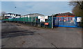
Blue entrance gate, Network Rail Westbury Depot
From Station Approach. This entrance is for Network Rail staff only. An arrow points left towards the Amey Colas railway depot.
Image: © Jaggery
Taken: 8 Mar 2014
0.07 miles
9
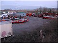
Winter Quarters
A view looking east over a compound off Slag Lane, used as a base by the Jennings Funfair.
Image: © Phil Williams
Taken: 26 Jan 2006
0.08 miles
10
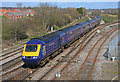
Train arriving at Westbury
First Great Western HST arriving at Westbury.
Image: © Wayland Smith
Taken: 18 Mar 2007
0.08 miles