1
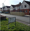
Park Road, Dilton Marsh
Viewed from the corner of High Street. The sign shows that Park Road
leads to The Crescent, The Avenue, The Circle and Woodland View.
Image: © Jaggery
Taken: 8 Mar 2014
0.07 miles
2
2010 : B3099 Dilton Marsh High Street
The B3099 passing through Dilton Marsh on its short (just over 2 miles) journey between Westbury Leigh and Frome market on the A36.
Image: © Maurice Pullin
Taken: 31 Jan 2010
0.09 miles
3
Welcome to Dilton Rovers FC, Dilton Marsh
Viewed from High Street looking south along Alan Powell Lane towards Dilton Marsh Playing Field.
Image: © Jaggery
Taken: 8 Mar 2014
0.11 miles
4
Dilton Marsh school
Viewed from School Lane. The Church of England primary school is on the south side of High Street, near the former school which has been converted to dwellings. http://www.geograph.org.uk/photo/3958508
Image: © Jaggery
Taken: 8 Mar 2014
0.11 miles
5
Interesting building in High Street, Dilton Marsh
Viewed from the corner of Alan Powell Lane. The building extends for nearly 20 metres away from the north side of High Street. Now in residential use, it looks like it used to be a church or perhaps a school, but research into its previous usage has been surprisingly fruitless.
Image: © Jaggery
Taken: 8 Mar 2014
0.13 miles
6
School gates, Dilton Marsh
Viewed from School Lane, on the south side of High Street, near the former school which has been converted to dwellings. http://www.geograph.org.uk/photo/3958508 This entrance is for staff and deliveries only.
Image: © Jaggery
Taken: 8 Mar 2014
0.13 miles
7
Former Kings Arms pub, Dilton Marsh
Long since converted to residential use, the former pub is on the corner of High Street and School Lane. A faint remnant of THE KINGS ARMS name remains between the upper and lower windows.
Image: © Jaggery
Taken: 8 Mar 2014
0.13 miles
8
Changing rooms building in Dilton Marsh Playing Field
The metal building is on the east side of the football pitch. http://www.geograph.org.uk/photo/3958576
Image: © Jaggery
Taken: 8 Mar 2014
0.13 miles
9
Holy Trinity Church, Dilton Marsh
The eastern aspect of Holy Trinity Church, Dilton Marsh.
Image: © Phil Williams
Taken: 15 Nov 2005
0.14 miles
10
Dilton Marsh buildings [2]
This former junior school was built in the 1840s at the same time as the adjacent church. Now converted into four dwellings, the building is constructed of coursed rubble stone under a tiled roof. There are 20th century extensions at the rear. Listed, grade II, with details at: https://historicengland.org.uk/listing/the-list/list-entry/1180679
Dilton Marsh is a linear village with a high street over one mile long. The village is about 1½ miles south west of the centre of the town of Westbury. The original settlement, Old Dilton, is some ¾ miles south east of the present village centre on the banks of the Biss Brook and is now no more than a couple of farm houses and the ancient St Mary's Church.
Image: © Michael Dibb
Taken: 29 Apr 2021
0.14 miles


![Dilton Marsh buildings [2]](https://s3.geograph.org.uk/geophotos/06/82/35/6823591_6ce4ac8e_120x120.jpg)