
IMAGES TAKEN NEAR TO
Stormore, WESTBURY, BA13 4BH
Introduction
This page details the photographs taken nearby to Stormore, BA13 4BH by members of the Geograph project.
The Geograph project started in 2005 with the aim of publishing, organising and preserving representative images for every square kilometre of Great Britain, Ireland and the Isle of Man.

There are currently over 7.5m images from over14,400 individuals and you can help contribute to the project by visiting https://www.geograph.org.uk
Image Map
Images are licensed for reuse under creativecommons.org/licenses/by-sa/2.0
Notes
- Clicking on the map will re-center to the selected point.
- The higher the marker number, the further away the image location is from the centre of the postcode.
Image Listing (18 Images Found)
Images are licensed for reuse under creativecommons.org/licenses/by-sa/2.0
Image
Details
Distance
1
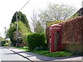
Telephone box, Dilton Marsh
K6 style telephone box at Stanmore.
Image: © Maigheach-gheal
Taken: 19 Apr 2009
0.02 miles
2
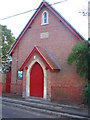
Stormore Baptist Chapel
Looking southeast to the frontage of Stormore Baptist Chapel.
Image: © Phil Williams
Taken: 15 Nov 2005
0.03 miles
3
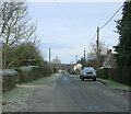
2010 : Minor road through Stormore
West of Dilton Marsh waiting for something to happen.
Image: © Maurice Pullin
Taken: 31 Jan 2010
0.06 miles
4
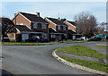
Greenacres, Dilton Marsh
Houses on the west side of a cul-de-sac, viewed across Stormore.
Image: © Jaggery
Taken: 8 Mar 2014
0.13 miles
5
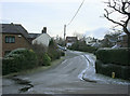
2010 : Clearwood west of Dilton Marsh
A small hamlet near Dilton Marsh.
Image: © Maurice Pullin
Taken: 31 Jan 2010
0.13 miles
6
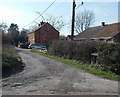
Northern end of Red Pit, Dilton Marsh
Viewed from the edge of the B3099 Clivey looking along Red Pit towards Stormore.
Image: © Jaggery
Taken: 8 Mar 2014
0.14 miles
7
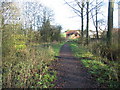
Approaching Stormore
A view looking to the northeast towards Stormore, along the track through Black Dog Woods.
Image: © Phil Williams
Taken: 17 Dec 2006
0.16 miles
8
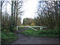
Entrance to Black Dog Woods
A view looking southwest to the entrance to Black Dog Woods from Stormore.
Image: © Phil Williams
Taken: 17 Dec 2006
0.16 miles
9
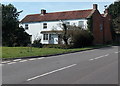
House on the corner of Clivey and Stormore, Dilton Marsh
The junction with Stormore on the left is the point where the B3099 High Street behind the camera become the B3099 Clivey ahead. A Clivey name sign is on the grass in the foreground.
Image: © Jaggery
Taken: 8 Mar 2014
0.17 miles
10
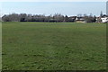
Dilton Marsh Playing Field
Located south of High Street, accessed via Alan Powell Lane, http://www.geograph.org.uk/photo/3958556
this is the home ground of Dilton Rovers FC (football club).
Image: © Jaggery
Taken: 8 Mar 2014
0.17 miles