
IMAGES TAKEN NEAR TO
Upland Rise, WESTBURY, BA13 3HW
Introduction
This page details the photographs taken nearby to Upland Rise, BA13 3HW by members of the Geograph project.
The Geograph project started in 2005 with the aim of publishing, organising and preserving representative images for every square kilometre of Great Britain, Ireland and the Isle of Man.

There are currently over 7.5m images from over14,400 individuals and you can help contribute to the project by visiting https://www.geograph.org.uk
Image Map
Images are licensed for reuse under creativecommons.org/licenses/by-sa/2.0
Notes
- Clicking on the map will re-center to the selected point.
- The higher the marker number, the further away the image location is from the centre of the postcode.
Image Listing (64 Images Found)
Images are licensed for reuse under creativecommons.org/licenses/by-sa/2.0
Image
Details
Distance
1
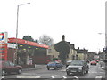
Warminster Road
A view looking southwest along the A350 Warminster Road, from the entrance to the Warminster Road car park (right). The edge of this square is at the far end of the garage forecourt.
Image: © Phil Williams
Taken: 14 Jan 2006
0.11 miles
2
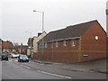
Warminster Road
A view looking northeast along the A350 warminster Road towards the mini-roundabout at the top of Haynes Road. The modern brick building at right is part of a housing society development named Vista Court. The name derives from the old cinema which formerly occupied this site.
Image: © Phil Williams
Taken: 14 Jan 2006
0.11 miles
3
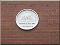
Vista Court plaque
Detail of the plaque on the end wall of one of the buildings of Vista Court, on the site of the old Vista cinema.
Image: © Phil Williams
Taken: 14 Jan 2006
0.11 miles
4
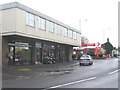
Warminster Road shops
A view looking southwest along the A350 Warminster Road, showing the small parade of shops and the Total petrol filling station.
Image: © Phil Williams
Taken: 14 Jan 2006
0.11 miles
5
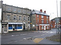
Warminster Road
A view looking north along the A350 Warminster Road towards the mini-roundabout at the top of Haynes Road, from the entrance to Vista Court. I should add that I have no connection with the firm of solicitors opposite!
Image: © Phil Williams
Taken: 14 Jan 2006
0.11 miles
6
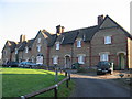
The Almshouses at Prospect Square
A view looking east to the Almshouse at Prospect Square.
Image: © Phil Williams
Taken: 28 Jan 2006
0.11 miles
7
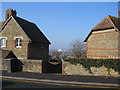
Prospect Place
A view looking slightly north of west to the entrance to Prospect Place from The Butts. The large white building in the distance is the milk processing facility on the West Wilts Trading Estate.
Image: © Phil Williams
Taken: 28 Jan 2006
0.11 miles
8
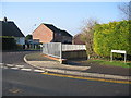
Snappersnipes
A view looking northwest to the entrance to the Snappersnipes footpath from The
Butts.
Image: © Phil Williams
Taken: 28 Jan 2006
0.11 miles
9
![Westbury houses [43]](https://s1.geograph.org.uk/geophotos/06/82/86/6828649_1fd7256f_120x120.jpg)
Westbury houses [43]
These 7 almshouses, numbers 17 to 23 Prospect Square, were built in 1869 of coursed rubble stone with dressed stone lintels, brick chimneys, quoins and bands under a tiled roof. Listed, grade II, with details at: https://historicengland.org.uk/listing/the-list/list-entry/
1180394
Prospect Square, a development of thirty-nine houses, was built by mill owner Abraham Laverton. Thirty-two were for his mill workers and seven were almshouses. The square is built on a sloping site around three sides of a large open space. The groups of stepped houses are in a revived vernacular style. Each group is of a different design reflected across the central axis.
Westbury is a former market town in the far west of Wiltshire under the north western edge of Salisbury Plain, 4 miles south of Trowbridge and 4 miles north of Warminster. Westbury was a centre of the cloth industry from the later 15th century until the 19th century. Malting was another important industry. There are now a number of large industrial and trading estates around the town with many residents working there. The town is an important junction point on the railway network with the Reading to Taunton line intersecting the line from Bristol to Southampton.
Image: © Michael Dibb
Taken: 29 Apr 2021
0.11 miles
10
![Westbury houses [42]](https://s3.geograph.org.uk/geophotos/06/82/86/6828631_0ab045f5_120x120.jpg)
Westbury houses [42]
Numbers 24 and 25 Prospect Square were built in 1869 of coursed rubble stone with brick chimneys, quoins and bands under a tiled roof. Numbers 15 and 16 Prospect Square at Image are the same design, reflected. Listed, grade II, with details at: https://historicengland.org.uk/listing/the-list/list-entry/
1036273
Prospect Square, a development of thirty-nine houses, was built by mill owner Abraham Laverton. Thirty-two were for his mill workers and seven were almshouses. The square is built on a sloping site around three sides of a large open space. The groups of stepped houses are in a revived vernacular style. Each group is of a different design reflected across the central axis.
Westbury is a former market town in the far west of Wiltshire under the north western edge of Salisbury Plain, 4 miles south of Trowbridge and 4 miles north of Warminster. Westbury was a centre of the cloth industry from the later 15th century until the 19th century. Malting was another important industry. There are now a number of large industrial and trading estates around the town with many residents working there. The town is an important junction point on the railway network with the Reading to Taunton line intersecting the line from Bristol to Southampton.
Image: © Michael Dibb
Taken: 29 Apr 2021
0.11 miles