IMAGES TAKEN NEAR TO
Bratton Road, WESTBURY, BA13 3EB
Introduction
This page details the photographs taken nearby to Bratton Road, BA13 3EB by members of the Geograph project.
The Geograph project started in 2005 with the aim of publishing, organising and preserving representative images for every square kilometre of Great Britain, Ireland and the Isle of Man.

There are currently over 7.5m images from over14,400 individuals and you can help contribute to the project by visiting https://www.geograph.org.uk
Image Map (Loading...)


Getting Data...Please wait
Leaflet Map data © OpenStreetMap
Images are licensed for reuse under creativecommons.org/licenses/by-sa/2.0
Notes
- Clicking on the map will re-center to the selected point.
- The higher the marker number, the further away the image location is from the centre of the postcode.
Image Listing (42 Images Found)
Images are licensed for reuse under creativecommons.org/licenses/by-sa/2.0
Image
Details
Distance
1
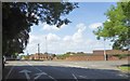
Road junction on the east edge of Westbury
The sign at the junction points to the railway station, taking the traffic away from the centre
Image: © David Smith
Taken: 1 Jun 2017
0.04 miles
5
![A circular walk from Bratton [78]](https://s2.geograph.org.uk/geophotos/06/48/25/6482510_20f3e1ca_120x120.jpg)
A circular walk from Bratton [78]
The path known as Donkey Lane continues as a public bridleway on the far side of Bratton Road, B3098.
The walk leaves Bratton heading northwest then turns west, circling around the former cement factory to the Old Coach Road on the edge of Westbury. The return is past the Westbury White Horse viewing site on a bridleway and then a track, Lower Westbury Road. About 5¾ miles.
Image: © Michael Dibb
Taken: 21 Apr 2020
0.09 miles
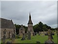
7
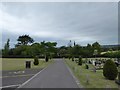
Westbury Cemetery: grave backs
The local tradition seems to put the name on the back too, like a football shirt. Have never seen before!
Image: © Basher Eyre
Taken: 22 Aug 2016
0.14 miles
8
![A circular walk from Bratton [77]](https://s3.geograph.org.uk/geophotos/06/48/25/6482507_a20741b4_120x120.jpg)
A circular walk from Bratton [77]
The line of Coach Road continues as a path known as Donkey Lane.
The walk leaves Bratton heading northwest then turns west, circling around the former cement factory to the Old Coach Road on the edge of Westbury. The return is past the Westbury White Horse viewing site on a bridleway and then a track, Lower Westbury Road. About 5¾ miles.
Image: © Michael Dibb
Taken: 21 Apr 2020
0.14 miles
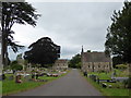
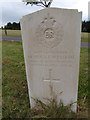
9
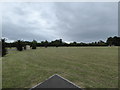
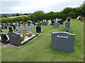
Westbury Cemetery: plenty of room for some more
Image: © Basher Eyre
Taken: 22 Aug 2016
0.14 miles
10
![A circular walk from Bratton [76]](https://s3.geograph.org.uk/geophotos/06/48/25/6482503_373e3753_120x120.jpg)
A circular walk from Bratton [76]
Coach Road forms a junction with Bitham Park from where are seen these modern houses in Cheyney Walk.
The walk leaves Bratton heading northwest then turns west, circling around the former cement factory to the Old Coach Road on the edge of Westbury. The return is past the Westbury White Horse viewing site on a bridleway and then a track, Lower Westbury Road. About 5¾ miles.
Image: © Michael Dibb
Taken: 21 Apr 2020
0.14 miles