
IMAGES TAKEN NEAR TO
Sion Hill, BATH, BA1 2UF
Introduction
This page details the photographs taken nearby to Sion Hill, BA1 2UF by members of the Geograph project.
The Geograph project started in 2005 with the aim of publishing, organising and preserving representative images for every square kilometre of Great Britain, Ireland and the Isle of Man.

There are currently over 7.5m images from over14,400 individuals and you can help contribute to the project by visiting https://www.geograph.org.uk
Image Map
Images are licensed for reuse under creativecommons.org/licenses/by-sa/2.0
Notes
- Clicking on the map will re-center to the selected point.
- The higher the marker number, the further away the image location is from the centre of the postcode.
Image Listing (95 Images Found)
Images are licensed for reuse under creativecommons.org/licenses/by-sa/2.0
Image
Details
Distance
1

Doric House, Cavendish Road, Bath
A bit of a curiosity which looks as if it might have been transplanted from Classical Greece. Typically austere but powerful. By Joseph Gandy, c1805. Grade II* listed.
Image: © Stephen Richards
Taken: 25 May 2012
0.02 miles
2
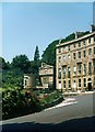
Cavendish Crescent (part) and Doric House, Bath, 1966
The crescent was built 1815-1830, by John Pinch the Elder, for William Broom, builder. Listed Grade II.
Doric House incorporates a house and picture gallery on a site that slopes down to rear. 1803. Gallery designed by Joseph Michael Gandy ARA (exhibited at the RA in 1803) for Charles Spackman, developer, for his friend and protege Thomas Barker (1769-1847). Listed Grade II*.
Image: © Alan Murray-Rust
Taken: 18 Jul 1966
0.04 miles
3

2-3 Cavendish Crescent, Bath
Two of the stately houses seen here Image The middle first-floor windows have cornices supported on elongated brackets.
Image: © Stephen Richards
Taken: 25 May 2012
0.04 miles
4
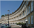
Cavendish Crescent, Bath
A quadrant of stately houses, each four storeys plus basement (Image]). Continuous platbands and cornice. Restrained and refined. By John Pinch, 1815-30. Grade II listed.
The terrace stands on one of Bath's raised pavements. Grade II listed.
Image: © Stephen Richards
Taken: 25 May 2012
0.05 miles
5
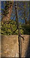
Mounted on the Wall
"Mounted on the Wall", Winifred's Lane, Lansdowne, Bath
A remnant of an earlier generation of 'public street furniture',
A wall mounted fence brace?
Image: © D M Wilmot
Taken: 15 Apr 2014
0.06 miles
6

Somerset Place, Bath (1)
A grand crescent distinguished by a massive broken segmental pediment containing paterae and swags and topped by a central urn. The pediment lends the terrace a slightly old-fashioned air. It is the sort of exuberant but gauche detail a provincial early Georgian builder might have put up. Disturbingly it is off-centre, a product of the building, which began in 1790, being interrupted by a lack of money and only being resumed c1820. John Eveleigh made the designs. Several houses were rebuilt after bomb damage in 1942. Grade I listed.
Owned by Bath Spa University until c2005 when the freehold was sold and these are now private houses.
Image: © Stephen Richards
Taken: 25 May 2012
0.07 miles
7
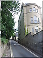
Winifred's Lane
Narrow leafy lanes such as this can be found in several places near the centre of Bath.
Image: © HelenK
Taken: 6 Jun 2007
0.07 miles
8
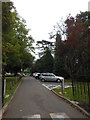
Sion Hill campus of Bath Spa University
The cedar tree in the grounds has a good claim to be the most beautiful tree in Bath; it can be seen outlined on the skyline from much of lower Lansdown.
Image: © HelenK
Taken: 8 Oct 2013
0.07 miles
9

High Common, Bath
Possibly an oak but I didn't get a good look.
Image: © Stephen Richards
Taken: 25 May 2012
0.07 miles
10
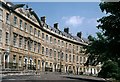
Somerset Place, Bath, 1966
Crescent of sixteen terrace houses, 1791-1820 (some restored after World War II bombing). By John Eveleigh. At the time part of Bath College of Domestic Science, it has since been re-converted to residential accommodation. Listed Grade I. For a 21st century comparison, see https://www.geograph.org.uk/photo/3824556
Image: © Alan Murray-Rust
Taken: 18 Jul 1966
0.07 miles