1
7-12 Oxford Row, Lansdown Road, Bath
Six houses built c1775, developed by local builder Thomas Warr Atwood who also practised as an architect so it's likely that he was also responsible for their design. Grade II listed.
It continues down the hill:
Image
Image: © Stephen Richards
Taken: 25 May 2012
0.01 miles
2
Belmont, Lansdown Road, Bath
A twenty-house terrace, some of the houses a storey higher than most of their contemporaries, but broadly similar in terms of the detail. Dated 1768-73. Unusually the architect has not been identified but several builder-architects active at the time in Bath must be candidates. Grade II listed.
The terrace stands behind a raised pavement and wrought-iron railings. Grade II listed.
Image: © Stephen Richards
Taken: 25 May 2012
0.01 miles
3
Benchmark, Lansdown Road and corner of Julian Road
Pollution and general deterioration has started to creep up the stone, but the mark itself seems steadfast. See http://www.bench-marks.org.uk/bm37541 for the Benchmark Database, and
Image] for a wider view.
Image: © Neil Owen
Taken: 8 Apr 2011
0.01 miles
4
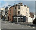
Corner house on Julian Road and Lansdown Road
An elegant town house overlooks the city of Bath, with a benchmark at its entrance
Image
Image: © Neil Owen
Taken: 8 Apr 2011
0.01 miles
5
Walcot School and the Star Inn, Vineyards, Bath
Image of the Walcot School Building, and a side view of the unusual Vineyards building which is home to the Star Inn public house.
Image: © lquara
Taken: 5 Jan 2005
0.02 miles
6
Bath from Beechen Cliff
Lansdown Road is the street with parked cars, running away from the camera, with Camden Crescent prominently curving round to the right. Further up Lansdown Road, and just in ST7466, is the west tower ("crazy", according to Pevsner) of St Stephen's church.
Nearer at hand, at bottom right, are the spire of
Image and part of the west end of the Abbey.
Image: © Derek Harper
Taken: 25 Aug 2008
0.02 miles
7
16-24 Bennett Street, Bath
The terraces in this and surrounding streets were designed by John Wood the Younger. The street was laid out in 1770-76. Typical, as in three bays and moulded window architraves. Plain but dignified. Grade II listed.
Image: © Stephen Richards
Taken: 25 May 2012
0.02 miles
8
Benchmark with iron feature
Cut benchmark, as described in the database , with a sharp-looking protector. Location is on Lansdown Road, opposite Bennett Street, and on the lower walkway below the pavement.
See http://www.bench-marks.org.uk/bm37540 for the Benchmark Database.
Image: © Neil Owen
Taken: 8 Apr 2011
0.02 miles
9
Challenger, Bath
The office of Challenger is on the corner of Belvedere (part of Lansdown Road)
and Guinea Lane. Challenger's business is residential property agency and consultancy.
Image: © Jaggery
Taken: 24 Sep 2011
0.03 miles
10
Christ Church, Julian Road, etc., from a balloon
We had just taken off from Victoria Park, flying roughly westwards. To the left of the church is the Museum of Bath at Work. To the right can just be seen the junction of Julian Road and Lansdown Hill (Belvedere). The line of the river is just below the top two rows of buildings.
Image: © Roger Beale
Taken: 21 Sep 2009
0.04 miles


