1
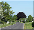
2010 : Copper maple, Sutton Veny
High Street is on the other side of the green.
Image: © Maurice Pullin
Taken: 22 May 2010
0.08 miles
2
Greenhill Gardens, Sutton Veny
Substantial brick house in the centre of the village. It carries a crest which is common in the village, just below the roofline.
http://suttonveny.co.uk/index.html
Image: © Colin Smith
Taken: 25 Feb 2009
0.10 miles
3
Crossroads at Sutton Veny
Image: © David Martin
Taken: 1 Oct 2018
0.11 miles
4
Old Direction Sign - Signpost by High Street, Sutton Veny
Pyramid top finial - 4 arms; Wilts. wooden by the UC road, in parish of Sutton Veny (West Wiltshire District), Sutton Veny, behind stone garden wall and hedge, village crossroads of High Street with Norton Road and Deverill Road.
Surveyed
Milestone Society National ID: WI_ST8942
Image: © Milestone Society
Taken: Unknown
0.11 miles
5
The Woolpack
Looks like the sad demise of yet another country pub. The sign has gone, a skip sits outside, workmen are inside - and the pub in Sutton Veny is closed.
Image: © Colin Smith
Taken: 25 Feb 2009
0.13 miles
6
Ornate gatehouse at Sutton Veny
Image: © David Martin
Taken: 1 Oct 2018
0.15 miles
7
2010 : Sutton Veny House
Now a nursing home, formerly Greenhill House.
"The earliest recorded reference to Greenhill House is 29 May 1822 when Miss Ann Hinton daughter of William Hinton, of Greenhill House sold some land in Newnham. A map dated 1804 does not show the house and as William Hinton died in 1816 (from an 'apoplectic fit') and it is believed that he built the house, then it is assumed that the house was built sometime between 1804 and the year of his death in 1816."
The above was copied from: http://suttonveny.co.uk/Local_History/Sutton_Veny_House/sutton_veny_house.html
Image: © Maurice Pullin
Taken: 22 May 2010
0.15 miles
8
Mind the step!
Flowery doorstep in High Street, Sutton Veny.
Image: © David Martin
Taken: 1 Oct 2018
0.15 miles
9
Post box at the junction of Norton Road and Everett Close
Image: © Basher Eyre
Taken: 13 Sep 2013
0.15 miles
10
2010 : Deverill Road entering Sutton Veny
The scene is dominated by a huge copper beech.
Image: © Maurice Pullin
Taken: 22 May 2010
0.19 miles


