Old Direction Sign - Signpost by High Street, Sutton Veny
Introduction
The photograph on this page of Old Direction Sign - Signpost by High Street, Sutton Veny by Milestone Society as part of the Geograph project.
The Geograph project started in 2005 with the aim of publishing, organising and preserving representative images for every square kilometre of Great Britain, Ireland and the Isle of Man.

There are currently over 7.5m images from over 14,400 individuals and you can help contribute to the project by visiting https://www.geograph.org.uk
Old Direction Sign - Signpost by High Street, Sutton Veny
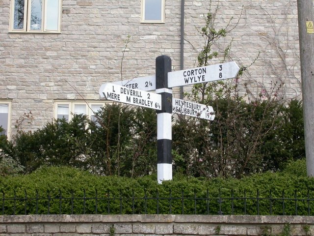
Image: © Milestone Society Taken: Unknown
Pyramid top finial - 4 arms; Wilts. wooden by the UC road, in parish of Sutton Veny (West Wiltshire District), Sutton Veny, behind stone garden wall and hedge, village crossroads of High Street with Norton Road and Deverill Road. Surveyed Milestone Society National ID: WI_ST8942
Images are licensed for reuse under creativecommons.org/licenses/by-sa/2.0
Image Location
Latitude
51.178751
Longitude
-2.147901