1
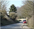
2011 : Leaving Tytherington, soon at Sutton Veny
This is the alternative road between Warminster and Salisbury, south of the A36 it avoids the rigours of the main road, you get into Wilton before returning to the madding crowd. If the sight of a few fields makes you feel ill or a cow or two can turn you off your lunch, forget it.
Image: © Maurice Pullin
Taken: 7 Mar 2011
0.09 miles
2
Road out of Tytherington towards Sutton Veny
Image: © Robin Webster
Taken: 2 Mar 2017
0.09 miles
3
Leaving Tytherington
A view looking to the northwest along the lane from Tytherington to Sutton Veny. The large thorny hedge at the right hides a large pond.
Image: © Phil Williams
Taken: 4 Feb 2007
0.11 miles
4
Hidden pond
A view looking to the northwest and down through the thorny hedge which hides this large pond from the casual passer-by on the lane between Tytherington to Sutton Veny.
Image: © Phil Williams
Taken: 4 Feb 2007
0.13 miles
5
By-way to Tytherington Hill
A view looking southeast towards the start of the by-way to Tytherington Hill.
Image: © Phil Williams
Taken: 4 Feb 2007
0.13 miles
6
2011 : Entering Tytherington
On the road from Sutton Veny.
Unfortunately Tytherington appears to be webshy, even in Wiki.
Image: © Maurice Pullin
Taken: 7 Mar 2011
0.15 miles
7
Milestone, Tytherington
Milestone set against the wall of Milestone Cottage. It is a cast iron pillar with lettering on front: Warminster Town Hall - 4 miles, Chilmark 6 miles. This is one of a series of cast iron milestones on roads radiating from Warminster that were made by Carson and Miller, Warminster ironfounders. It is dated 1840.
Image: © Maigheach-gheal
Taken: 28 Jun 2009
0.15 miles
8
Rush hour in Tytherington
Image: © Basher Eyre
Taken: 13 Sep 2013
0.15 miles
9
Old Milepost in Tytherington, Sutton Veny Parish
Cast iron post by the UC road, in parish of SUTTON VENY (WEST WILTSHIRE District), Tytherington; 300m West of church, leaning against North West cottage wall, on South East side of road. C&M Classical iron casting, erected by the Warminster turnpike trust in the 19th century.
Inscription reads:- : WARMINSTER / TOWN.HALL / 4 / MILES / CHILMARK / 6 / MILES : : C&M 1840 / W. :
Grade II Listed. List Entry Number: 1300450
Milestone Society National ID: WI_WMCM04.
Image: © M Faherty
Taken: 8 Apr 2007
0.16 miles
10
Milestone Cottage, Tytherington
Mid 17th century thatch cottage that is Grade II listed. It is named after the milestone set against the wall.
Image
Image: © Maigheach-gheal
Taken: 28 Jun 2009
0.16 miles


