
IMAGES TAKEN NEAR TO
Pinmore, FROME, BA11 4RA
Introduction
This page details the photographs taken nearby to Pinmore, BA11 4RA by members of the Geograph project.
The Geograph project started in 2005 with the aim of publishing, organising and preserving representative images for every square kilometre of Great Britain, Ireland and the Isle of Man.

There are currently over 7.5m images from over14,400 individuals and you can help contribute to the project by visiting https://www.geograph.org.uk
Image Map
Images are licensed for reuse under creativecommons.org/licenses/by-sa/2.0
Notes
- Clicking on the map will re-center to the selected point.
- The higher the marker number, the further away the image location is from the centre of the postcode.
Image Listing (8 Images Found)
Images are licensed for reuse under creativecommons.org/licenses/by-sa/2.0
Image
Details
Distance
1
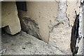
Damaged benchmark on the former Red Lion Inn
Ordnance Survey cut mark benchmark described on the Bench Mark Database at http://www.bench-marks.org.uk/bm51677
Image: © Roger Templeman
Taken: 20 Sep 2013
0.14 miles
2
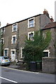
#147 The Butts, formerly The Red Lion
There is an OS benchmark Image on the stone jamb on the left hand side of the pale blue door partly obscured by a pile of paving stones
Image: © Roger Templeman
Taken: 20 Sep 2013
0.14 miles
3
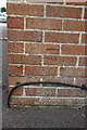
Benchmark on Frome Auto Electrical and Diesel
Ordnance Survey cut mark benchmark described on the Bench Mark Database at http://www.bench-marks.org.uk/bm51663
Image: © Roger Templeman
Taken: 20 Sep 2013
0.19 miles

5
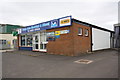
Frome Auto Electrical & Diesel, Marston Trading Estate
The premises on Manor Road has an OS benchmark Image on the side of the facing angle
Image: © Roger Templeman
Taken: 20 Sep 2013
0.20 miles
6
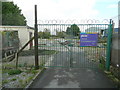
Death of a nursery
This site to the south of Frome town centre used to be a nursery and garden centre run as a work-experience project for disabled people.
Image: © Jonathan Billinger
Taken: 25 Nov 2009
0.23 miles
7
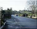
2008 : Marston Lane, Frome
Leading to Marston Gate at the bottom of the hill.
Image: © Maurice Pullin
Taken: 9 Dec 2008
0.24 miles
8

Old Milestone by the B3090, The Butts, Frome parish
Metal plate attached to stone post by the B3090, in parish of FROME (MENDIP District), The Butts, junction between Marston Gate and Frome Centre, set into stone garden wall of No.108, on West side of road. Old Bruton iron plate, erected by the Bruton turnpike trust in the 18th century.
Inscription reads:-
TO
BRUTON
10
Grade II listed.
List Entry Number: 1296693 https://historicengland.org.uk/listing/the-list/list-entry/1296693
Milestone Society National ID: SO_BNFR10.
Image: © JR Dowding
Taken: 21 Feb 2009
0.24 miles