
IMAGES TAKEN NEAR TO
Dallimore Lane, FROME, BA11 4NA
Introduction
This page details the photographs taken nearby to Dallimore Lane, BA11 4NA by members of the Geograph project.
The Geograph project started in 2005 with the aim of publishing, organising and preserving representative images for every square kilometre of Great Britain, Ireland and the Isle of Man.

There are currently over 7.5m images from over14,400 individuals and you can help contribute to the project by visiting https://www.geograph.org.uk
Image Map
Images are licensed for reuse under creativecommons.org/licenses/by-sa/2.0
Notes
- Clicking on the map will re-center to the selected point.
- The higher the marker number, the further away the image location is from the centre of the postcode.
Image Listing (191 Images Found)
Images are licensed for reuse under creativecommons.org/licenses/by-sa/2.0
Image
Details
Distance
3
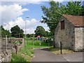
Footpath to play area
Path off the High Street, which continues round to the village hall.
Image: © Rose and Trev Clough
Taken: 8 Jul 2012
0.13 miles
4
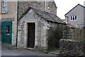
The Guard House, Nunney.
Village Lock up from about 1700. Grade II Listed.
Image: © Andrew Riley
Taken: 20 Mar 2007
0.14 miles
5
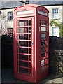
Telephone box, Nunney
K6 style telephone box in the centre of the village.
Image: © Maigheach-gheal
Taken: 16 Mar 2009
0.15 miles
6
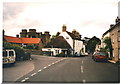
Junction of Castle St,Church St and Market Place, Nunney
Image: © Humphrey Bolton
Taken: 21 Aug 1998
0.15 miles
8
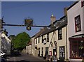
The George at Nunney
Signs across the road, usually sponsored by the AA, were once a common sight advertising the local coaching inn. Presumably most were removed as vehicles became taller, but here is one that remains on Nunney High Street.
Image: © Graham Horn
Taken: 3 May 2007
0.16 miles
9
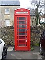
K6 telephone box
A K6 telephone box, designed in 1935 by Sir Giles Gilbert Scott. Listed, grade II, with details at: https://historicengland.org.uk/listing/the-list/list-entry/1253335
Image: © Michael Dibb
Taken: 11 Dec 2018
0.16 miles
10
![Nunney Houses [11]](https://s2.geograph.org.uk/geophotos/06/06/05/6060598_240d96d1_120x120.jpg)
Nunney Houses [11]
Number 15 Horn Street is late 17th century with later alterations. Listed, grade II, with details at: https://historicengland.org.uk/listing/the-list/list-entry/1058306
Image: © Michael Dibb
Taken: 11 Dec 2018
0.16 miles