
IMAGES TAKEN NEAR TO
Grove Lane, FROME, BA11 4AT
Introduction
This page details the photographs taken nearby to Grove Lane, BA11 4AT by members of the Geograph project.
The Geograph project started in 2005 with the aim of publishing, organising and preserving representative images for every square kilometre of Great Britain, Ireland and the Isle of Man.

There are currently over 7.5m images from over14,400 individuals and you can help contribute to the project by visiting https://www.geograph.org.uk
Image Map
Images are licensed for reuse under creativecommons.org/licenses/by-sa/2.0
Notes
- Clicking on the map will re-center to the selected point.
- The higher the marker number, the further away the image location is from the centre of the postcode.
Image Listing (21 Images Found)
Images are licensed for reuse under creativecommons.org/licenses/by-sa/2.0
Image
Details
Distance
1
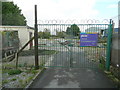
Death of a nursery
This site to the south of Frome town centre used to be a nursery and garden centre run as a work-experience project for disabled people.
Image: © Jonathan Billinger
Taken: 25 Nov 2009
0.07 miles
2
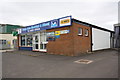
Frome Auto Electrical & Diesel, Marston Trading Estate
The premises on Manor Road has an OS benchmark Image on the side of the facing angle
Image: © Roger Templeman
Taken: 20 Sep 2013
0.12 miles
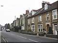
4

Garages on Rossiter's Road for houses on The Butts
The roadside wall of #53 has been removed to provide additional parking
Image: © Roger Templeman
Taken: 20 Sep 2013
0.12 miles
5
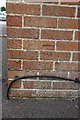
Benchmark on Frome Auto Electrical and Diesel
Ordnance Survey cut mark benchmark described on the Bench Mark Database at http://www.bench-marks.org.uk/bm51663
Image: © Roger Templeman
Taken: 20 Sep 2013
0.13 miles
6

Houses on Water Lane
An odd sequence of house numbers: left to right is 19,18,20,21.
Image: © Roger Templeman
Taken: 20 Sep 2013
0.15 miles
7
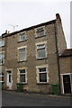
#23 Water Lane
There is an OS benchmark Image on the stone lintel right of the green wheelie bin
Image: © Roger Templeman
Taken: 20 Sep 2013
0.16 miles
8
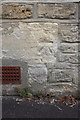
Benchmark on #23 Water Road
Ordnance Survey cut mark benchmark described on the Bench Mark Database at http://www.bench-marks.org.uk/bm51283
Image: © Roger Templeman
Taken: 20 Sep 2013
0.16 miles
9

Play Area off Newington Close, Keyford
Image: © Alex McGregor
Taken: 22 Aug 2012
0.17 miles
10
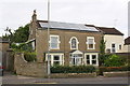
House on west side of Culverhill
There is an OS benchmark Image on the gatepost at left hand edge of the image
Image: © Roger Templeman
Taken: 20 Sep 2013
0.17 miles