IMAGES TAKEN NEAR TO
Stonebridge Drive, FROME, BA11 2SB
Introduction
This page details the photographs taken nearby to Stonebridge Drive, BA11 2SB by members of the Geograph project.
The Geograph project started in 2005 with the aim of publishing, organising and preserving representative images for every square kilometre of Great Britain, Ireland and the Isle of Man.

There are currently over 7.5m images from over14,400 individuals and you can help contribute to the project by visiting https://www.geograph.org.uk
Image Map (Loading...)


Getting Data...Please wait
Leaflet Map data © OpenStreetMap
Images are licensed for reuse under creativecommons.org/licenses/by-sa/2.0
Notes
- Clicking on the map will re-center to the selected point.
- The higher the marker number, the further away the image location is from the centre of the postcode.
Image Listing (11 Images Found)
Images are licensed for reuse under creativecommons.org/licenses/by-sa/2.0
Image
Details
Distance
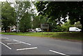
1

All Weather Pitches, Frome Leisure Centre
Image: © Des Blenkinsopp
Taken: 30 Jul 2019
0.05 miles
2

Merlin Theatre, Frome
Looking southeast over the outdoor performance space at the Merlin Theatre, Frome. The amphitheatre is surrounded by standing stones of limestone and sandstone. Snow can be seen lying on the north facing slopes of Cley Hill, near Warminster, just left of the white carved stone at centre.
Image: © Phil Williams
Taken: 29 Nov 2005
0.11 miles
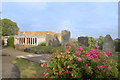
3

The Ecos Amphitheatre
A classic stone amphitheatre beside the more traditional indoor Merlin Theatre. Both theatres share their use between the community and the college in whose grounds they are situated.
The Ecos Theatre was opened in 1992. http://www.merlintheatre.co.uk/ecos/
Image: © Des Blenkinsopp
Taken: 31 Jul 2019
0.14 miles
4
Frome Community Hospital
Set back from the northeast side of Rodden Road, accessed via Enos Way.
Image: © Jaggery
Taken: 11 Mar 2017
0.16 miles
5
Merlin Theatre, Frome
Opened in 1974, the Merlin Theatre is part of the Frome Community College campus. It is used by both the college and the wider community. The standing stones are part of the Ecos Amphitheatre, an open air performance area beside the theatre which opened in 1992.
Seen here in a rather stormy light, weather warnings had caused the open air show we had come to see to be moved next door into the dry. Always useful to have a plan B.
Merlin Theatre info. on http://www.merlintheatre.co.uk/about-us/
Image: © Des Blenkinsopp
Taken: 30 Jul 2019
0.17 miles
6
Bath Road houses, Frome
Houses on the east side of the B3090 Bath Road.
Image: © Jaggery
Taken: 11 Mar 2017
0.20 miles
7
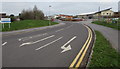
Enos Way, Frome
From Rodden Road along Enos Way towards Frome Community Hospital. http://www.geograph.org.uk/photo/5308264
Image: © Jaggery
Taken: 11 Mar 2017
0.23 miles
8

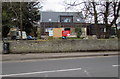
Old Milestone by the B3090, Bath Road, Frome parish
Stone post (plate lost) by the B3090, in parish of FROME (MENDIP District), by Fromefield House, just North of junction with Rodden Road, set in wall, on West side of road. Erected by the Black Dog turnpike trust in the 19th century.
Inscription not recorded.
Somerset HER.
HER number: 37608 https://www.heritagegateway.org.uk/Gateway/Results_Single.aspx?uid=37608&resourceID=100
Milestone Society National ID: SO_FR00.
Image: © JR Dowding
Taken: 7 Aug 2009
0.24 miles
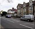
9
Bath Road house construction, Frome
House construction (or perhaps reconstruction) in progress on the west side of Bath Road on March 11th 2017.
Image: © Jaggery
Taken: 11 Mar 2017
0.24 miles