
IMAGES TAKEN NEAR TO
Lower Rudge, FROME, BA11 2QE
Introduction
This page details the photographs taken nearby to BA11 2QE by members of the Geograph project.
The Geograph project started in 2005 with the aim of publishing, organising and preserving representative images for every square kilometre of Great Britain, Ireland and the Isle of Man.

There are currently over 7.5m images from over14,400 individuals and you can help contribute to the project by visiting https://www.geograph.org.uk
Image Map
Images are licensed for reuse under creativecommons.org/licenses/by-sa/2.0
Notes
- Clicking on the map will re-center to the selected point.
- The higher the marker number, the further away the image location is from the centre of the postcode.
Image Listing (15 Images Found)
Images are licensed for reuse under creativecommons.org/licenses/by-sa/2.0
Image
Details
Distance
1
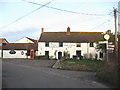
Lower Rudge
A view looking northeast to the junction of the minor road from Brokerswood (right) showing the Full Moon public house. Note the old style signpost at right.
Image: © Phil Williams
Taken: 17 Jan 2006
0.02 miles
2
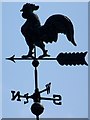
Weather vane, Lower Rudge
Cockerels were often used as weather vanes due to a belief that the creature was feared by the Devil, and were placed at the highest point of a building.
Image: © Maigheach-gheal
Taken: 19 Apr 2009
0.03 miles
4
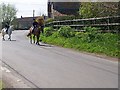
Street scene, Lower Rudge
The horses were heading up the lane towards the next public house aptly named the Kicking Donkey.
Image: © Maigheach-gheal
Taken: 19 Apr 2009
0.06 miles
5
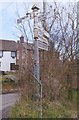
Old Direction Sign - Signpost in Lower Rudge, Beckington Parish
Pyramid finial - 4 arms; Somerset SCC pyramid by the UC road, in parish of Beckington (Mendip District), Rudge Lane junction with Rudge Hill and lane to Brokerswood, Lower Rudge.
Surveyed
Milestone Society National ID: SO_ST8251.
Image: © Milestone Society
Taken: Unknown
0.07 miles
6
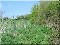
Footpath, Lower Rudge
The footpath allows walkers to walk from Lower Rudge to Scotland Lane.
Image: © Maigheach-gheal
Taken: 19 Apr 2009
0.07 miles
7
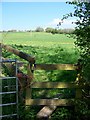
Footpath, Lower Rudge
The stile gives access to the footpath that takes walkers from Rudge Lane to Scotland Farm.
Image: © Maigheach-gheal
Taken: 19 Apr 2009
0.07 miles
8
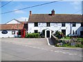
The Full Moon, Lower Rudge
The inn was built in the 17th century and is Grade II listed.
Image: © Maigheach-gheal
Taken: 19 Apr 2009
0.08 miles
9
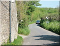
2008 : Rudge, the lane to Brokerswood
The cement works chimney at Westbury ST8852 is in the background.
Image: © Maurice Pullin
Taken: 6 May 2008
0.12 miles
10
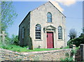
2008 : Wesleyan Chapel, Rudge
Dating from 1839.
For a biography of John Wesley see http://www.brycchancarey.com/abolition/wesley.htm
Image: © Maurice Pullin
Taken: 6 May 2008
0.17 miles