
IMAGES TAKEN NEAR TO
Spring Gardens, FROME, BA11 2PA
Introduction
This page details the photographs taken nearby to BA11 2PA by members of the Geograph project.
The Geograph project started in 2005 with the aim of publishing, organising and preserving representative images for every square kilometre of Great Britain, Ireland and the Isle of Man.

There are currently over 7.5m images from over14,400 individuals and you can help contribute to the project by visiting https://www.geograph.org.uk
Image Map
Images are licensed for reuse under creativecommons.org/licenses/by-sa/2.0
Notes
- Clicking on the map will re-center to the selected point.
- The higher the marker number, the further away the image location is from the centre of the postcode.
Image Listing (26 Images Found)
Images are licensed for reuse under creativecommons.org/licenses/by-sa/2.0
Image
Details
Distance
1

Coalash Lane
This view of Coalash Lane, looking west, is taken from the bridge over the River Frome. Road junction on the left is to Lower Innox.
Image: © Roger Gittins
Taken: 16 May 2009
0.02 miles
2
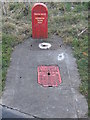
Water filling point
This filling point for water bowsers used for supplying water to outdoor events etc, is sited at the road junction at Spring Gardens.
Image: © Phil Williams
Taken: 25 Feb 2006
0.08 miles
3
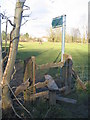
Spring Gardens
This stile on the footpath leading off Cuckoo Lane shows signs of extensive usage. A view looking north across the meadow.
Image: © Phil Williams
Taken: 25 Feb 2006
0.08 miles
4
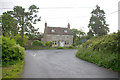
Hurst
This 17th century cottage stands in grounds of 1/3 acre at the junction of Coalash Jefferies and Jacks Lane (in view), Spring Gardens Frome.
Image: © Roger Gittins
Taken: 16 May 2009
0.08 miles
5

Holiday cottage, Hurst
Image: © Roger Gittins
Taken: 18 May 2009
0.09 miles
6

River Frome
At the junction of Coalash Lane and the lane to Innox Hill. This view is from the bridge on Coalash Lane - the river flows North.
Image: © Roger Gittins
Taken: 16 May 2009
0.11 miles
7
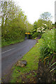
Coalash Lane
Railway line bridge over Coalash Lane
Image: © Roger Gittins
Taken: 18 May 2009
0.11 miles
8
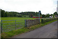
Footpath from Jefferies Lane to Coalash Lane
Jefferies Lane in the foreground.
Image: © Roger Gittins
Taken: 16 May 2009
0.11 miles
9
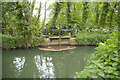
Marston Mill Sluice Gate
Discharging water from the mill leat into the Mells River just visible through the gate top.
Image: © Roger Gittins
Taken: 16 May 2009
0.12 miles
10

Railway to Great Elm
At this point the footpath crosses the line; best not dawdle, but time for another photo in the other direction Image
Parapets are for the bridge crossing Jack's Lane.
Image: © Roger Gittins
Taken: 18 May 2009
0.13 miles