1
Bath Road houses, Frome
Houses on the east side of the B3090 Bath Road.
Image: © Jaggery
Taken: 11 Mar 2017
0.04 miles
2
Frome Community Hospital
Set back from the northeast side of Rodden Road, accessed via Enos Way.
Image: © Jaggery
Taken: 11 Mar 2017
0.07 miles
3
Bath Road house construction, Frome
House construction (or perhaps reconstruction) in progress on the west side of Bath Road on March 11th 2017.
Image: © Jaggery
Taken: 11 Mar 2017
0.08 miles
4
Old Milestone by the B3090, Bath Road, Frome parish
Stone post (plate lost) by the B3090, in parish of FROME (MENDIP District), by Fromefield House, just North of junction with Rodden Road, set in wall, on West side of road. Erected by the Black Dog turnpike trust in the 19th century.
Inscription not recorded.
Somerset HER.
HER number: 37608 https://www.heritagegateway.org.uk/Gateway/Results_Single.aspx?uid=37608&resourceID=100
Milestone Society National ID: SO_FR00.
Image: © JR Dowding
Taken: 7 Aug 2009
0.09 miles
5
The Co-op on Rodden Road, Frome
Image: © David Howard
Taken: 5 May 2018
0.10 miles
6
Enos Way, Frome
From Rodden Road along Enos Way towards Frome Community Hospital. http://www.geograph.org.uk/photo/5308264
Image: © Jaggery
Taken: 11 Mar 2017
0.11 miles
7
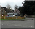
Direction signs on a suburban corner of Frome
On the corner of Rodden Road and the B3090. Left for Marston Trading Estate, Glastonbury, Warminster, Radstock. Right for Frome town centre, tourist information, arts & crafts centre, St John Ambulance HQ.
Image: © Jaggery
Taken: 11 Mar 2017
0.11 miles
8
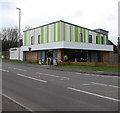
Distinctively coloured shop in Frome
The Co-operative Fromefield at 1 Rodden Road.
Image: © Jaggery
Taken: 11 Mar 2017
0.12 miles
9
The Co-operative Fromefield, Frome
Distinctively coloured shop viewed across Rodden Road.
Image: © Jaggery
Taken: 11 Mar 2017
0.12 miles
10
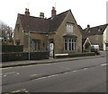
Grade II listed 2 and 4 Bath Road, Frome
Built in 1833 as a dame school (a school for young children, usually kept by a woman). Grade II listed in 1983.
Image: © Jaggery
Taken: 11 Mar 2017
0.14 miles


