
IMAGES TAKEN NEAR TO
Quaperlake Street, BRUTON, BA10 0HA
Introduction
This page details the photographs taken nearby to Quaperlake Street, BA10 0HA by members of the Geograph project.
The Geograph project started in 2005 with the aim of publishing, organising and preserving representative images for every square kilometre of Great Britain, Ireland and the Isle of Man.

There are currently over 7.5m images from over14,400 individuals and you can help contribute to the project by visiting https://www.geograph.org.uk
Image Map
Images are licensed for reuse under creativecommons.org/licenses/by-sa/2.0
Notes
- Clicking on the map will re-center to the selected point.
- The higher the marker number, the further away the image location is from the centre of the postcode.
Image Listing (216 Images Found)
Images are licensed for reuse under creativecommons.org/licenses/by-sa/2.0
Image
Details
Distance
2
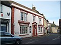
Bruton Pharmacy
The pharmacy has a Georgian facade.
Image: © Maigheach-gheal
Taken: 22 Jan 2008
0.02 miles
3
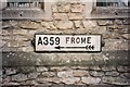
Direction Sign ? Signpost
Located facing northwest below the ground floor windows of the library on the southeast corner of the junction of Quaperlake Street and Palwell Street in Bruton parish. 1 arm and no finial.
Milestone Society National ID: SO_ST6834A
Image: © W Marsh
Taken: Unknown
0.02 miles
4
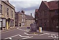
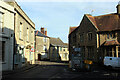
East end of High Street, Bruton
Looking into Quaperlake Street from High Street with the library straight ahead.
Image: © Stephen McKay
Taken: Unknown
0.02 miles
6
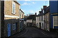
Patwell Street, Bruton
Adopted by A359, seen curving down towards the River Brue, from High Street
Image: © Chris Heaton
Taken: 2 Feb 2022
0.02 miles
7
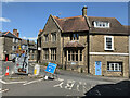
The Library, Bruton
At the junction of High Street and Patwell Street.
Image: © Andrew Abbott
Taken: 13 Jun 2021
0.02 miles
8

Ordnance Survey Flush Bracket S6714
This can be found on the wall of a building in High Street.
For more detail see : http://www.bench-marks.org.uk/bm2579
Image: © Peter Wood
Taken: 30 Mar 2014
0.02 miles
9

Coombe and Quaperlade Streets, Bruton
Coombe Street runs to the left, and Quaperlade to the right.
Image: © Chris Heaton
Taken: 2 Feb 2022
0.02 miles
10
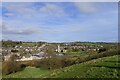
Bruton from the dovecote hill
Settled in the valley of the River Brue ('Brue' is a Celtic river name meaning 'brisk' https://www.oxfordreference.com/view/10.1093/acref/9780199609086.001.0001/acref-9780199609086-e-2391?rskey=qEu9I3&result=2401 ) . King's Bruton school, founded in 1519, on the other side of the railway line; and Church of St Mary beyond.
Image: © Tim Heaton
Taken: 2 Feb 2022
0.02 miles