IMAGES TAKEN NEAR TO
St. Bernards Road, SOLIHULL, B92 7BP
Introduction
This page details the photographs taken nearby to St. Bernards Road, B92 7BP by members of the Geograph project.
The Geograph project started in 2005 with the aim of publishing, organising and preserving representative images for every square kilometre of Great Britain, Ireland and the Isle of Man.

There are currently over 7.5m images from over14,400 individuals and you can help contribute to the project by visiting https://www.geograph.org.uk
Image Map
Images are licensed for reuse under creativecommons.org/licenses/by-sa/2.0
Notes
- Clicking on the map will re-center to the selected point.
- The higher the marker number, the further away the image location is from the centre of the postcode.
Image Listing (14 Images Found)
Images are licensed for reuse under creativecommons.org/licenses/by-sa/2.0
Image
Details
Distance
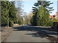
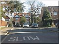
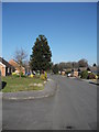
2
St Bernards Road at Mereside Way (southern end)
Image: © Peter Whatley
Taken: 11 Feb 2012
0.10 miles
3
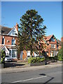
45 St Bernards Road
Araucaria araucana
Image: © araucaria araucana
Taken: 19 Feb 2013
0.14 miles
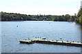
4
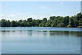
Olton Mere (3)
Olton Mere is a large secluded expanse of water in the heart of Birmingham's eastern suburbs. The reservoir supplies water to the nearby Grand Union Canal and is also the home of Olton Mere Sailing Club. This photograph was taken by permission of British Waterways staff.
Image: © Andy F
Taken: 24 Jun 2009
0.15 miles
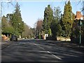
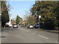
5
Gunns Way
The houses in view are on Kineton Green Road.
Image: © Peter Whatley
Taken: 11 Feb 2012
0.18 miles
7
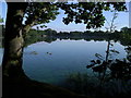
Olton Mere Looking North
Olton Mere is owned by British Waterways Board and leased by Olton Mere Sailing Club. Walking access is also available and the approximately 1 mile walk around the lake gives wide open views not often available in such a built-up area. The Lake has been used for recreational sailing since Victorian times. The sailing club can be found at https://www.oltonmere.co.uk/
Image: © Liz
Taken: 6 Aug 2006
0.18 miles
8
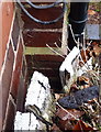
OS benchmark - Kineton Green; 159 Kineton Green Road
Low down on the brickwork (behind the disintegrating flower planter in the foreground) there is an OS cutmark, which was originally levelled at 126.705m above Ordnance Datum Newlyn.
Image: © Richard Law
Taken: 13 Dec 2016
0.19 miles
10
Olton Mere (5)
Olton Mere is a large secluded expanse of water in the heart of Birmingham's eastern suburbs. The reservoir supplies water to the nearby Grand Union Canal and is also the home of Olton Mere Sailing Club. This photograph was taken by permission of British Waterways staff.
Image: © Andy F
Taken: 24 Jun 2009
0.20 miles