IMAGES TAKEN NEAR TO
Ferndown Road, SOLIHULL, B91 2AX
Introduction
This page details the photographs taken nearby to Ferndown Road, B91 2AX by members of the Geograph project.
The Geograph project started in 2005 with the aim of publishing, organising and preserving representative images for every square kilometre of Great Britain, Ireland and the Isle of Man.

There are currently over 7.5m images from over14,400 individuals and you can help contribute to the project by visiting https://www.geograph.org.uk
Image Map
Images are licensed for reuse under creativecommons.org/licenses/by-sa/2.0
Notes
- Clicking on the map will re-center to the selected point.
- The higher the marker number, the further away the image location is from the centre of the postcode.
Image Listing (43 Images Found)
Images are licensed for reuse under creativecommons.org/licenses/by-sa/2.0
Image
Details
Distance
1
OS benchmark - Worlds End, Greswold Primary School
An OS cutmark on the school's electricity/gas meter station at the roadside on Buryfield Road; originally levelled at 132.69m above Ordnance Datum Newlyn.
Image: © Richard Law
Taken: 20 Mar 2015
0.09 miles
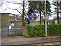
2
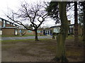
Greswold Primary School
On Buryfield Road
Image: © Graham Butcher
Taken: 24 Dec 2011
0.10 miles
3
Greswold School
My first school! I was there when this building opened, which would have been in about 1960. I remember we all had to carry our chairs across (holding them on our heads) from our old classroom in what became known as the 'Infant School', to our new classrooms in the posh new 'Junior School'. Being a Junior instead of an Infant, seemed such an advancement in life!
Image: © Richard Paxman
Taken: 25 Jun 2006
0.10 miles
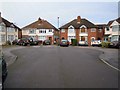
6
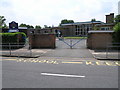
Greswold Primary School
One of the entrances on Buryfield Road
Image: © Graham Butcher
Taken: 24 Dec 2011
0.12 miles
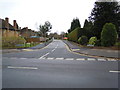
7
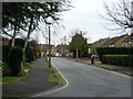
Lighthorne Road, Solihull
Cul-de-sac end
Image: © Graham Butcher
Taken: 28 Dec 2011
0.14 miles
8

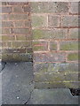
OS benchmark - Worlds End, 133 Buryfield Road
An OS cutmark on what is effectively the side wall of no 133, facing into Links Drive. Originally levelled at 134.72m above Ordnance Datum Newlyn
Image: © Richard Law
Taken: 20 Mar 2015
0.15 miles
9
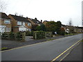
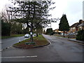
Ferndown Road, Solihull
Taken from Buryfield Road
Image: © Graham Butcher
Taken: 24 Dec 2011
0.15 miles
10
Seven Star Road
Service road (to right) and main road (to left)
Image: © Graham Butcher
Taken: 31 Dec 2011
0.16 miles