
IMAGES TAKEN NEAR TO
Upper Gungate, TAMWORTH, B79 7EA
Introduction
This page details the photographs taken nearby to Upper Gungate, B79 7EA by members of the Geograph project.
The Geograph project started in 2005 with the aim of publishing, organising and preserving representative images for every square kilometre of Great Britain, Ireland and the Isle of Man.

There are currently over 7.5m images from over14,400 individuals and you can help contribute to the project by visiting https://www.geograph.org.uk
Image Map
Images are licensed for reuse under creativecommons.org/licenses/by-sa/2.0
Notes
- Clicking on the map will re-center to the selected point.
- The higher the marker number, the further away the image location is from the centre of the postcode.
Image Listing (271 Images Found)
Images are licensed for reuse under creativecommons.org/licenses/by-sa/2.0
Image
Details
Distance
1
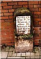
Old Milestone by the B5493, Upper Gungate, Tamworth
Metal plate attached to stone post by the B5493 (was A453), in parish of TAMWORTH (TAMWORTH District), Upper Gungate, 45m North of Hospital Street junction, in paving in front of brick wall, on North West side of road, opposite petrol station. Tamworth iron plate, erected by the Tamworth turnpike trust in the 19th century.
Inscription reads:-
SUTTON. 8
BIRM. 15
MEASHAM. 9
ASHBY. 13
BREEDON. 18
CAS. DON. 22
SAWLEY. 25½
NOTT. 35
Grade II listed. List Entry Number: 1208773
https://historicengland.org.uk/listing/the-list/list-entry/1208773
Milestone Society National ID: ST_TMNT00.
Image: © J Higgins
Taken: 1 Jan 2001
0.01 miles
2
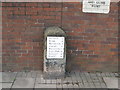
From here to... - Tamworth, Staffordshire
Here in Upper Gungate stands an old milestone originally placed here in about the 19th century by the Tamworth Turnpike Trust. It gives the mileages to Sutton (Coldfield) 8 Birm(ingham) 15 Measham 9 Ashby (de la Zouch) 13 Breedon (on the Hill) 18 1/4 Cas. Don. (Castle Donington) 22 Sawley 25 1/2 Nott(ingham) 35.
Time photo taken 3.39 pm BST (British Summer Time).
Image]
Image]
Milestone Society National ID: ST_TMNT00
Image: © Martin Richard Phelan
Taken: 3 Oct 2019
0.02 miles
3
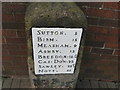
From here to ... again - Tamworth, Staffordshire
A closer view of the milestone featured in Image It gives the mileages to Sutton (Coldfield) 8 Birm(ingham) 15 Measham 9 Ashby (de la Zouch) 13 Breedon (on the Hill) 18 1/4 Cas. Don. (Castle Donington) 22 Sawley 25 1/2 Nott(ingham) 35. Time photo taken 3.39 pm BST (British Summer Time).
Image]
Milestone Society National ID: ST_TMNT00
Image: © Martin Richard Phelan
Taken: 3 Oct 2019
0.02 miles
4
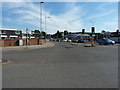
From Aldergate into Upper Gungate
Upper Gungate, also known as the A513, forms one of the main routes north out of Tamworth.
Image: © Richard Law
Taken: 6 Jul 2018
0.02 miles
5
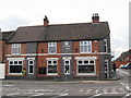
Upper Gungate aid post - Tamworth, Staffordshire
A fourth defibrillator seen on my afternoon out in Tamworth here in Upper Gungate. This one is sited on the outside of the building occupied by the Tamworth Co-op Funeral Service. No smart remarks please. On some of these machines you need to call a number first for the entry code, which must delay things somewhat but prevents possible damage or misuse. What perhaps is needed is a map of locations where these machines are sited. Time photo taken 3.42 pm BST (British Summer Time).
Image: © Martin Richard Phelan
Taken: 3 Oct 2019
0.03 miles
6

Upper Gungate and Offa Drive Road Junction (3)
These photographs Image and Image show another view of this junction but from a different view point.
Image: © Chris' Buet
Taken: 11 Aug 2009
0.04 miles
7
Upper Gungate and Offa Drive Road Junction (1)
Image: © Chris' Buet
Taken: 11 Aug 2009
0.04 miles
8
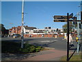
Hollies Medical Practice
The building in the distance with the flat roof is Hollies Medical practice, this photo was taken across the A5003, which is the road that goes from left to right, across the photograph.
Image: © Chris' Buet
Taken: 22 Oct 2008
0.04 miles
9

A view of the A5003 (2)
This photograph shows a North facing view of the A5003. This photograph Image shows another view of the A5003.
Image: © Chris' Buet
Taken: 22 Oct 2008
0.05 miles
10
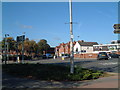
A View of the A5003 (1)
This photograph shows a view of the A5003,which is the road that is going from left to right in the photograph. The road that meets the A5003 in the very right hand corner is the very end of Gungate road, as it merges with the A5003.
Image: © Chris' Buet
Taken: 22 Oct 2008
0.05 miles