IMAGES TAKEN NEAR TO
Portleys Lane, TAMWORTH, B78 2AA
Introduction
This page details the photographs taken nearby to Portleys Lane, B78 2AA by members of the Geograph project.
The Geograph project started in 2005 with the aim of publishing, organising and preserving representative images for every square kilometre of Great Britain, Ireland and the Isle of Man.

There are currently over 7.5m images from over14,400 individuals and you can help contribute to the project by visiting https://www.geograph.org.uk
Image Map
Images are licensed for reuse under creativecommons.org/licenses/by-sa/2.0
Notes
- Clicking on the map will re-center to the selected point.
- The higher the marker number, the further away the image location is from the centre of the postcode.
Image Listing (9 Images Found)
Images are licensed for reuse under creativecommons.org/licenses/by-sa/2.0
Image
Details
Distance
1
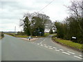
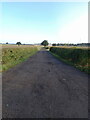
Lane junction west of Drayton Bassett
Portleys Lane branches off south, right, to Brook Farm.
Image: © Jonathan Billinger
Taken: 15 Mar 2010
0.04 miles
2
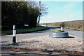
Attractive Island at the Junction of Portleys Lane and Drayton Lane
Image: © Mick Malpass
Taken: 1 Mar 2012
0.05 miles
3
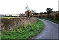
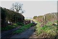
Portleys Lane, Drayton Bassett
This is a back lane that avoids the main village of Drayton Bassett. The building in the centre is Brook Farm.
Image: © Rob Farrow
Taken: 26 Nov 2006
0.11 miles
4
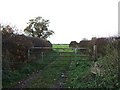
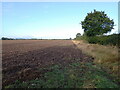
Field Entrance off Portleys Lane
As Portleys Lane bends 90º there is this gated access to a field with the hedges on either side delineating the boundaries of two other fields.
Image: © Rob Farrow
Taken: 26 Nov 2006
0.11 miles
7
Heathley Farm entrance off the Drayton Lane
Image: © Mick Malpass
Taken: 1 Mar 2012
0.21 miles
8
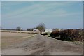
Access road to Heathley Farm
In the 12 years or so since Image was taken, the hedge on the left of this track has appeared, although it looks like one across the field near the tree has been grubbed out.
Image: © Richard Law
Taken: 21 Sep 2023
0.22 miles
9
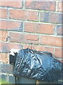
OS benchmark - Drayton Bassett, Brook Farm
An OS cutmark on the wall of an outbuilding/garage at the farm, last levelled by the OS in 1961 at 76.3m Ordnance Datum Newlyn.
Image: © Richard Law
Taken: 21 Sep 2023
0.23 miles