
IMAGES TAKEN NEAR TO
Tamworth Road, TAMWORTH, B77 1BU
Introduction
This page details the photographs taken nearby to Tamworth Road, B77 1BU by members of the Geograph project.
The Geograph project started in 2005 with the aim of publishing, organising and preserving representative images for every square kilometre of Great Britain, Ireland and the Isle of Man.

There are currently over 7.5m images from over14,400 individuals and you can help contribute to the project by visiting https://www.geograph.org.uk
Image Map
Images are licensed for reuse under creativecommons.org/licenses/by-sa/2.0
Notes
- Clicking on the map will re-center to the selected point.
- The higher the marker number, the further away the image location is from the centre of the postcode.
Image Listing (10 Images Found)
Images are licensed for reuse under creativecommons.org/licenses/by-sa/2.0
Image
Details
Distance
1
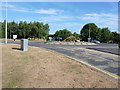
Roundabout on Tamworth Road
Situated in Mount Pleasant, this roundabout directs most northbound traffic off to the left, up Peeler's Way, and towards the inner Tamworth Ring Road. All other directions are mostly residential.
Image: © Richard Law
Taken: 6 Jul 2018
0.09 miles
2
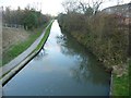
Coventry Canal from Peelers Way - view Northwards
As the eastbound Coventry Canal passes under Peelers Way on the outskirts of Tamworth it takes quite a sharp turn northwards. This is the view from the bridge looking at this northward section. The view from the opposite side of the bridge can be seen here Image]
Image: © Rob Farrow
Taken: 27 Nov 2011
0.21 miles
3
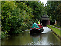
Coventry Canal east of Fazeley in Staffordshire
Looking south towards bridge No 75A.
The approaching working boat is Lynx, No 39. It is a former Fellows, Morton and Clayton boat built in 1913.
Image: © Roger D Kidd
Taken: 26 Sep 2016
0.21 miles
4
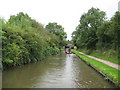
Coventry Canal: Mount Pleasant, Tamworth, Reach
The canal runs straight and due north-south here before making the turn to go under the A51 road bridge, visible in the distance, and then over Image
Image: © Nigel Cox
Taken: 10 Sep 2012
0.22 miles
5
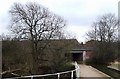
Peelers Way Bridge over Coventry Canal
I don't know if this new red brick & concrete bridge is called "Peelers Way Bridge", but that is the name of the road it is carrying over the canal. Peelers Way is the A51 on the outskirts of Tamworth.
Image: © Rob Farrow
Taken: 23 Feb 2008
0.22 miles
6
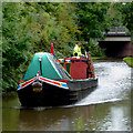
Working narrowboat east of Fazeley in Staffordshire
Looking south towards bridge No 75A across the Coventry Canal.
The approaching working boat is Lynx, No 39. It is a former Fellows, Morton and Clayton boat built in 1913.
Image: © Roger D Kidd
Taken: 26 Sep 2016
0.22 miles
7
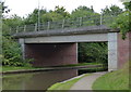
Peelers Way Bridge No 75A
Crossing the Coventry Canal in Tamworth.
Image: © Mat Fascione
Taken: 13 Sep 2015
0.24 miles
8
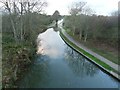
Coventry Canal from Peelers Way - view SW
Peelers Way is the main A51 as it approaches Tamworth between Mount Pleasant and Kettlebrook. This is the view roughly southwestwards from the bridge over the Coventry Canal. The pinch-point in the canal that can be seen ahead, is the aqueduct over the River Tame which can be seen in close-up here Image] Image] Image]
In the last of those three linked photos, the bridge in the distance is the one from which this photo was taken.
The view from the opposite side of the bridge can be seen here Image]
Image: © Rob Farrow
Taken: 27 Nov 2011
0.24 miles
9

Coventry Canal east of Fazeley Junction, Staffordshire
Looking east-north-east towards the Tame Aqueduct. Beyond it is Peelers Way Bridge, No 75A. Off to the left is the Tameside Local Nature Reserve.
Image: © Roger Kidd
Taken: 15 Jun 2010
0.25 miles
10
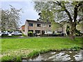
Houses on Broadsmeath
From the Coventry Canal.
Image: © Andrew Abbott
Taken: 30 Apr 2023
0.25 miles