
IMAGES TAKEN NEAR TO
Bodmin Grove, BIRMINGHAM, B7 4PG
Introduction
This page details the photographs taken nearby to Bodmin Grove, B7 4PG by members of the Geograph project.
The Geograph project started in 2005 with the aim of publishing, organising and preserving representative images for every square kilometre of Great Britain, Ireland and the Isle of Man.

There are currently over 7.5m images from over14,400 individuals and you can help contribute to the project by visiting https://www.geograph.org.uk
Image Map
Images are licensed for reuse under creativecommons.org/licenses/by-sa/2.0
Notes
- Clicking on the map will re-center to the selected point.
- The higher the marker number, the further away the image location is from the centre of the postcode.
Image Listing (30 Images Found)
Images are licensed for reuse under creativecommons.org/licenses/by-sa/2.0
Image
Details
Distance
1
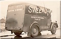
Chimney sweep's van
This chimney sweep and his van were parked up outside my late father's fireplace business on Oliver Street around the time the area was undergoing great changes and regeneration in the 1950s.
Image: © Derek Bennett
Taken: 7 Feb 1959
0.07 miles
2
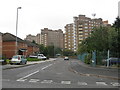
Monster blocks of flats, seen from Melvina Road
Image: © Peter Whatley
Taken: 22 Sep 2008
0.07 miles
3
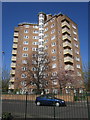
North Tower
This is one of a block of some of the first flats built in Birmingham in the 1950's.
Image: © Derek Bennett
Taken: 1 Apr 2012
0.08 miles
4
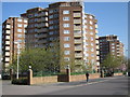
Birmingham's first flats
These were some of the very first flats built in Duddeston, Birmingham in the 1950's. My father's business was nearby, I was a child when watching them being built.
Image: © Derek Bennett
Taken: 1 Apr 2012
0.09 miles
5
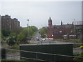
Nechells Parkway
The building with the green roof is the local library.
Image: © Row17
Taken: 3 May 2008
0.11 miles
6
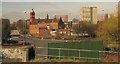
Bloomsbury, Birmingham
A similar view to Image The listed Bloomsbury Branch Library, with its copper dome, dates from about 1893, and is a "striking composition in pink terracotta" http://list.english-heritage.org.uk/resultsingle.aspx?uid=1234054&searchtype=mapsearch . The building on this side of it, the Prime Lodge hotel, is mapped as the Eagle pub. The tower block to the right is Thames Tower. Behind are the gasholders shown at http://www.geograph.org.uk/search.php?i=31990738 . In the foreground is a roundabout; Nechells Parkway, leading uphill past the library, is the A47.
Image: © Derek Harper
Taken: 6 Apr 2012
0.14 miles
8
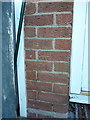
OS benchmark - Aston, 65 Rupert Street
An OS cutmark on the front wall of a small house/flat at the corner of Rupert St and Oliver St; originally levelled, probably in 1964, at 109.48m above Ordnance Datum Newlyn.
Image: © Richard Law
Taken: 28 Feb 2017
0.15 miles
9
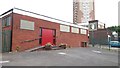
Bloomsbury Evangelical Free Church
This church in Bloomsbury Street was established in 1860 and is obviously not the original building - this entire inner city area was cleared and rebuilt in the post-war era. Behind the church the Foaming Tankard pub, currently to let, can be seen, and above is the 1969 20-storey Victor Tower.
Image: © Paul Collins
Taken: 26 Jun 2017
0.15 miles
10
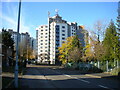
North end of Little Hall Road, Duddeston
Off Melvina Road.
Image: © Richard Vince
Taken: 19 Nov 2022
0.15 miles