IMAGES TAKEN NEAR TO
Dovey Tower, Duddeston Manor Road, BIRMINGHAM, B7 4LE
Introduction
This page details the photographs taken nearby to Dovey Tower, Duddeston Manor Road, B7 4LE by members of the Geograph project.
The Geograph project started in 2005 with the aim of publishing, organising and preserving representative images for every square kilometre of Great Britain, Ireland and the Isle of Man.

There are currently over 7.5m images from over14,400 individuals and you can help contribute to the project by visiting https://www.geograph.org.uk
Image Map
Images are licensed for reuse under creativecommons.org/licenses/by-sa/2.0
Notes
- Clicking on the map will re-center to the selected point.
- The higher the marker number, the further away the image location is from the centre of the postcode.
Image Listing (36 Images Found)
Images are licensed for reuse under creativecommons.org/licenses/by-sa/2.0
Image
Details
Distance
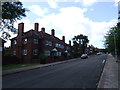
1
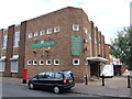
Vauxhall Sports & Social Club, Nechells
Image: © Chris Whippet
Taken: 3 Aug 2014
0.02 miles
2
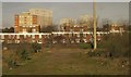
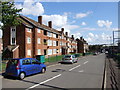
Housing in Nechells
A view from a train south of Duddeston Station. The nearest housing, with two-storey rows and three higher blocks behind them, is on Hindlow Close. Behind on the left, with bright orangey edges, is Willow House (9 storeys). The rear three 16-storey tower blocks are Dovey Tower (1967), Humber Tower (1965) and Trent Tower (1968).
Image: © Derek Harper
Taken: 6 Apr 2012
0.07 miles
3
City View
Birmingham City centre viewed from the aptly named City View in Saltley.
Image: © Carl Baker
Taken: 7 Oct 2006
0.10 miles
6
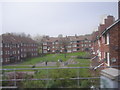
Flats seen from the railway
Scene from the railway line, these flats are typical of the type built in Birmingham during the early 1950's.
Image: © Row17
Taken: 3 May 2008
0.14 miles
7
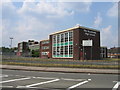
The Heartlands High School
Seen from Great Francis Street.
Image: © David Stowell
Taken: 2 Jul 2006
0.15 miles
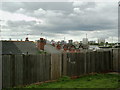
9
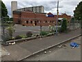
Seventh Day Adventist Church
Cleaning up on Forster Street
Image: © Michael Westley
Taken: 22 May 2022
0.18 miles
10
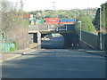
Erskine Street bridge
Bridge carrying railway, just south of Duddeston station. Container depot beyond the bridge is accessed by rail from Saltley (not the same route).
It looks so countryfied beyond. Don't be confused - this is the heart of Birmingham - ahead is Adderley Park and Bordesley Green.
Image: © Michael Westley
Taken: 6 Apr 2011
0.18 miles