1
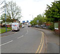
Lyttleton Street, West Bromwich
Viewed from the edge of the White Swan http://www.geograph.org.uk/photo/2933908 looking along Lyttleton Street towards Sams Lane.
Image: © Jaggery
Taken: 5 May 2012
0.14 miles
2
The Prince Albert
A free house on Sams Lane, West Bromwich.
Image: © Richard Law
Taken: 29 Nov 2016
0.17 miles
3
Lyttleton Street leads into Sams Lane
Here at the junction with Horton St and the Prince Albert pub on the right, Lyttleton St changes name to become Sams Lane, leading on to Spon Lane in about 1/4 of a mile.
Image: © Richard Law
Taken: 29 Nov 2016
0.18 miles
4
Forresters DIY shop and cafe
Forresters is on Ault Street and Bullock Street runs down the side and is lined by a variety of industrial premises.
Image: © Chris Allen
Taken: 12 Feb 2020
0.23 miles
5
Robert Hopkins Environmental from Bullock Street
This company is a waste management company and this site is described as a five acre fully permitted transfer and recycling facility. The chimney is clearly visible from the elevated section of the M5 between junctions 1 and 2.
Image: © Chris Allen
Taken: 12 Feb 2020
0.24 miles
6
Kelvin energy from waste plant, West Bromwich
The construction is a new energy from waste plant to be called the Kelvin plant and operated by Enfinium. It is a £500 million project and will process (incinerate) 395,000 tonnes of waste per year and generate 44MW of electricity, making it amongst the biggest such plants to date. There are ambitious aspirations that it may one day contribute to net zero with carbon capture and electrolytic hydrogen production. This structure houses the top-hung water tube boiler and to its right is a huge concrete storage bunker. The plant is due to commission in 2025.
Image: © Chris Allen
Taken: 11 Nov 2023
0.24 miles
7
Spon Lane middle lock
The middle of three locks on the Birmingham Canal Navigations (Spon Lane locks branch) that links the old and new main lines from Birmingham to Wolverhampton.
Image: © Chris Allen
Taken: 11 Nov 2023
0.24 miles
8
The Flower Pot, West Bromwich
Image: © Chris Whippet
Taken: 21 Dec 2013
0.25 miles
9
New flats and housing on Lyttleton Street, West Bromwich
Image: © Richard Law
Taken: 29 Nov 2016
0.25 miles
10
Lyttleton Street, West Bromwich
Looking along Lyttleton Street, from the junction with Bromford Lane.
Image: © David Weston
Taken: 15 Jul 2018
0.25 miles


