
IMAGES TAKEN NEAR TO
Anvil Walk, WEST BROMWICH, B70 0BB
Introduction
This page details the photographs taken nearby to Anvil Walk, B70 0BB by members of the Geograph project.
The Geograph project started in 2005 with the aim of publishing, organising and preserving representative images for every square kilometre of Great Britain, Ireland and the Isle of Man.

There are currently over 7.5m images from over14,400 individuals and you can help contribute to the project by visiting https://www.geograph.org.uk
Image Map
Images are licensed for reuse under creativecommons.org/licenses/by-sa/2.0
Notes
- Clicking on the map will re-center to the selected point.
- The higher the marker number, the further away the image location is from the centre of the postcode.
Image Listing (38 Images Found)
Images are licensed for reuse under creativecommons.org/licenses/by-sa/2.0
Image
Details
Distance
1

Hadley Bridge, Wednesbury Old Canal
This is a stretch of the truncated Wednesbury Old Canal, now a short dead-end arm often referred to as the Ridgacre (or Ridgeacre) Branch. Although officially navigable, a stretch of about 200 yards a little further along is completely choked with weeds. The red panel in the bridge parapet is a common feature of canals in the Birmingham area, provided to allow the fire service access to water.
Image: © Stephen McKay
Taken: 9 Jan 2015
0.17 miles
2
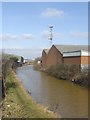
Wednesbury Old Canal
Looking towards the terminus at Black Lake.
Image: © John M
Taken: 21 Feb 2009
0.18 miles
3

Wednesbury Old Canal - Hadley Bridge
The canal is truncated at the Black Country Spine Road. This section passes through a highly industrialised area and the water is obviously highly polluted as can be seen from the colour.
Image: © John M
Taken: 21 Feb 2009
0.19 miles
4
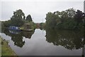
Wednesbury Old Canal off Walsall Canal
aka Balls Hill Branch Canal
Image: © Ian S
Taken: 25 Jul 2021
0.19 miles
5

Ryders Green Junction, Wednesbury Old Canal
Where the Walsall Canal (left) meets the Wednesbury Old Canal. The latter links the former to the Birmingham Main Line Canal (half a mile or so behind the photographer), but north of here is only navigable for a short distance. The bridge across the Walsall Canal that linked the towpaths of the Wednesbury Old Canal either side of the junction has been removed. Ryders Green Top Lock can be seen on the left just beyond the site of the bridge.
Image: © Richard Vince
Taken: 1 Feb 2020
0.20 miles
6
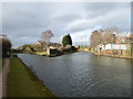
Ryders Green Junction
This is where the Wednesbury Old Canal Main Line meets the Walsall Canal end on. The latter continues straight ahead to Ryders Green Locks. The Wednesbury Old Canal, also known as the Balls Hill Branch, continues to the right. A footbridge at the junction has been removed and the canal to the right is considered as not navigable.
Image: © Chris Allen
Taken: 29 Feb 2020
0.20 miles
7

Ryder's Green Junction
This is a part of the canal network that relatively few boaters ever reach. To the right the Wednesbury Old Canal continues a short distance to the modern end of navigation at Swan Village; nowadays it is often referred to as the Ridgacre (or Ridgeacre) Branch although this is historically inaccurate. A short distance beyond this junction the branch was found to be completely choked with weed and impassable (see Image). To the left is the start of the Walsall Canal which immediately descends through the eight Ryder's Green Locks; mooring posts for boats waiting to enter the locks can be seen on the left of the picture. The brickwork is what remains of a turnover bridge which would have allowed a horse drawn boat to proceed along the Wednesbury Old Canal without detaching the tow rope.
Image: © Stephen McKay
Taken: 9 Jan 2015
0.20 miles
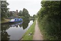
9

Wednesbury Old Canal Main Line near Ryders Green Junction
Spot the heron!
Image: © David Martin
Taken: 21 Sep 2019
0.21 miles
