IMAGES TAKEN NEAR TO
Vicarage Street, OLDBURY, B68 8JS

Introduction

This page details the photographs taken nearby to Vicarage Street, B68 8JS by members of the Geograph project.

The Geograph project started in 2005 with the aim of publishing, organising and preserving representative images for every square kilometre of Great Britain, Ireland and the Isle of Man.

There are currently over 7.5m images from over14,400 individuals and you can help contribute to the project by visiting https://www.geograph.org.uk

Image Map


Images are licensed for reuse under creativecommons.org/licenses/by-sa/2.0
Notes
  • Clicking on the map will re-center to the selected point.
  • The higher the marker number, the further away the image location is from the centre of the postcode.

Image Listing (44 Images Found)

Images are licensed for reuse under creativecommons.org/licenses/by-sa/2.0
  • ...
Image
Details
Distance
1
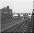
Langley Green railway station
Opened in 1885 by the Great Western Railway on the line from Birmingham Snow Hill to Stourbridge. View south towards Rowley Regis and Stourbridge. Just out of view to the right is the former branch line platform to Oldbury Town.
Image: © Nigel Thompson Taken: 1 May 2010
0.03 miles
2
Langley Green Station
Image: © Roy Hughes Taken: 29 Mar 2013
0.04 miles
3
Footbridge, Langley Green Station
Image: © Roy Hughes Taken: 29 Mar 2013
0.04 miles
4
Langley Green Station
Original station buildings from train waiting to go south to Stourbridge Junction. Signalbox under footbridge is close to end of platform. Beyond the signalbox was once a short branch line under Western Road to Oldbury town.
Image: © Michael Westley Taken: Unknown
0.06 miles
5
Langley Maltings on Western Road
In happier times (1994, at which time it was still in use) the former Wolverhampton & Dudley Brewery's maltings looked like Image Operations closed in early 2006, and much of the roofs and tower structures were subsequently destroyed by fire later about 3 years later, with arson strongly suspected at the time. It's now looking extremely sorry for itself, despite the 1974 Grade II listing https://britishlistedbuildings.co.uk/101279047-langley-maltings-st-pauls-ward & https://historicengland.org.uk/listing/the-list/list-entry/1279047, and is considered 'At Risk'. There were several burnt-out or vandalised & abandoned cars parked outside the frontage on this day.
Image: © Richard Law Taken: 20 May 2019
0.08 miles
6
Langley Maltings
I believe these are closed and facing an uncertain future.
Image: © Chris Allen Taken: 2 Jan 1994
0.09 miles
7
Langley Green - Langley Maltings
On Western Road. For an earlier (1994) photo, please see Chris Allen's Image For more on the sad story of this building, please see http://www.midlandsheritage.co.uk/industrial/3667-langley-maltings-wolverhampton-dudley-breweries.html .
Image: © Dave Bevis Taken: 19 Apr 2014
0.09 miles
8
Langley Maltings
First view from the other end. Not much traffic on the 2nd of January.
Image: © Chris Allen Taken: 2 Jan 1994
0.09 miles
9
Railway towards Langley Green Station
From the level crossing on the B4182, Oldbury.
Image: © JThomas Taken: 22 Aug 2019
0.09 miles
10
Langley Maltings and the BCN Titford branch
These maltings were formerly owned by the Wolverhampton and Dudley Brewery. The canal is a relative backwater which is probably only visited by hardened canal enthusiasts.
Image: © Alan Murray-Rust Taken: 22 Apr 2007
0.10 miles
  • ...