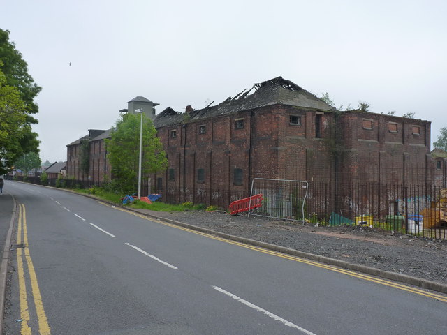
Langley Maltings on Western Road
Introduction
The photograph on this page of Langley Maltings on Western Road by Richard Law as part of the Geograph project.
The Geograph project started in 2005 with the aim of publishing, organising and preserving representative images for every square kilometre of Great Britain, Ireland and the Isle of Man.
There are currently over 7.5m images from over 14,400 individuals and you can help contribute to the project by visiting https://www.geograph.org.uk

Image: © Richard Law Taken: 20 May 2019
In happier times (1994, at which time it was still in use) the former Wolverhampton & Dudley Brewery's maltings looked like Image Operations closed in early 2006, and much of the roofs and tower structures were subsequently destroyed by fire later about 3 years later, with arson strongly suspected at the time. It's now looking extremely sorry for itself, despite the 1974 Grade II listing https://britishlistedbuildings.co.uk/101279047-langley-maltings-st-pauls-ward & https://historicengland.org.uk/listing/the-list/list-entry/1279047, and is considered 'At Risk'. There were several burnt-out or vandalised & abandoned cars parked outside the frontage on this day.

