IMAGES TAKEN NEAR TO
Highfield Lane, HALESOWEN, B63 4RX
Introduction
This page details the photographs taken nearby to Highfield Lane, B63 4RX by members of the Geograph project.
The Geograph project started in 2005 with the aim of publishing, organising and preserving representative images for every square kilometre of Great Britain, Ireland and the Isle of Man.

There are currently over 7.5m images from over14,400 individuals and you can help contribute to the project by visiting https://www.geograph.org.uk
Image Map
Images are licensed for reuse under creativecommons.org/licenses/by-sa/2.0
Notes
- Clicking on the map will re-center to the selected point.
- The higher the marker number, the further away the image location is from the centre of the postcode.
Image Listing (13 Images Found)
Images are licensed for reuse under creativecommons.org/licenses/by-sa/2.0
Image
Details
Distance
1
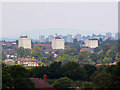
Tower blocks, Halesowen
The blocks of what are probably Dudley Metropolitan Borough Council dwellings are as seen from the western edge of the northbound Frankley motorway services area. From left to right the blocks are in Pickersleigh Close, Broome Close and Honeybourne Close although their postal addresses are given as Hill Street. For another view from the same viewpoint please see this image http://www.geograph.org.uk/photo/1932985
Image: © Brian Robert Marshall
Taken: 25 Jun 2010
0.12 miles
2
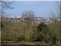
Halesowen Skyline
Part of Halesowen with Seth Somers Park in the foreground.
Image: © Stephen Rogerson
Taken: 20 Mar 2015
0.15 miles
5
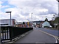
Lidl View
The view towards the supermarket along Hagley Road, Halesowen.
Image: © Gordon Griffiths
Taken: 26 Aug 2012
0.20 miles
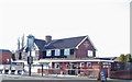
6
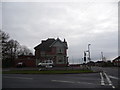
The Hunting Tree pub, Halesowen
The pub stands alone near the crest of the hill.
Image: © Jeremy Bolwell
Taken: 3 Jan 2013
0.21 miles
7
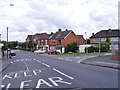
Quarry Lane
The junction with Hagley Road, Halesowen.
Image: © Gordon Griffiths
Taken: 26 Aug 2012
0.21 miles
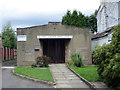
8
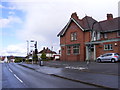
The Hunting Tree
A Pub on Alexandra Road Hasbury near Halesowen.
Image: © Gordon Griffiths
Taken: 27 Aug 2011
0.22 miles
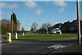
10

Huntingtree Road Island at Alexandra Road
Image: © Roy Hughes
Taken: 11 Jan 2018
0.22 miles