IMAGES TAKEN NEAR TO
Uffmoor Lane, HALESOWEN, B63 1DL
Introduction
This page details the photographs taken nearby to Uffmoor Lane, B63 1DL by members of the Geograph project.
The Geograph project started in 2005 with the aim of publishing, organising and preserving representative images for every square kilometre of Great Britain, Ireland and the Isle of Man.

There are currently over 7.5m images from over14,400 individuals and you can help contribute to the project by visiting https://www.geograph.org.uk
Image Map
Images are licensed for reuse under creativecommons.org/licenses/by-sa/2.0
Notes
- Clicking on the map will re-center to the selected point.
- The higher the marker number, the further away the image location is from the centre of the postcode.
Image Listing (10 Images Found)
Images are licensed for reuse under creativecommons.org/licenses/by-sa/2.0
Image
Details
Distance
1
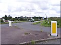
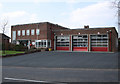
Manor Way Junction
The view of the dual carriageway from Uffmoor Lane, Halesowen.
Image: © Gordon Griffiths
Taken: 26 Aug 2012
0.08 miles
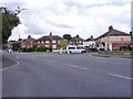
2
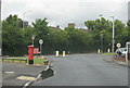
Halesowen - Uffmoor Lane Looking Towards Hagley Road
Image: © Roy Hughes
Taken: 26 May 2011
0.10 miles
3
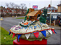
A Post Box Topper, Uffmoor Lane, Hasbury
Located on the junction with Hagley Road, leading into Halesowen. The Church on the topper appears to depict St. Kenelm's Church, located about a mile South-West.
Image: © Oliver Mills
Taken: 10 Feb 2023
0.11 miles
4
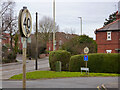
"Antique" speed restrictor signs, Uffmoor Estate, Hasbury
Located just on the outskirts of Halesowen, on the junction with Hagley Road. The housing estate these signs were erected for appears to date to the 1920s, with the road junction improved by the early Post-War era; these speed restrictor signs likely date from then. Their design is in accordance with the "Pre-Worboys" road signage standards; which was superseded by today's standards in 1964. Whilst most outdated signage nationwide has been replaced, this complete set of four speed-restrictor signposts (double-sided: 30 heading into the estate, 40 heading out; two further posts not here seen), somehow, still survives. Whilst the red ring has inevitably faded, the black numbering is surprisingly clear. The flat top of the 3 is the most obvious distinguishing feature.
Image: © Oliver Mills
Taken: 10 Feb 2023
0.11 miles
5
Uffmoor Estate Junction
The view of Hagley Road, Halesowen.
Image: © Gordon Griffiths
Taken: 26 Aug 2012
0.12 miles
6
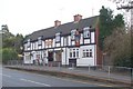
The Rose and Crown, Hagley Road, Hasbury, Halesowen
Image: © billypicks
Taken: 7 Feb 2009
0.20 miles
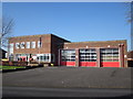
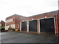
10
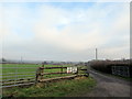
Uffmoor Lane Halesowen Entrance to Tack Farm
Image: © Roy Hughes
Taken: 11 Jan 2018
0.25 miles