
IMAGES TAKEN NEAR TO
Manor Way, HALESOWEN, B62 8RN
Introduction
This page details the photographs taken nearby to Manor Way, B62 8RN by members of the Geograph project.
The Geograph project started in 2005 with the aim of publishing, organising and preserving representative images for every square kilometre of Great Britain, Ireland and the Isle of Man.

There are currently over 7.5m images from over14,400 individuals and you can help contribute to the project by visiting https://www.geograph.org.uk
Image Map
Images are licensed for reuse under creativecommons.org/licenses/by-sa/2.0
Notes
- Clicking on the map will re-center to the selected point.
- The higher the marker number, the further away the image location is from the centre of the postcode.
Image Listing (12 Images Found)
Images are licensed for reuse under creativecommons.org/licenses/by-sa/2.0
Image
Details
Distance
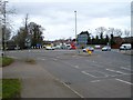
2
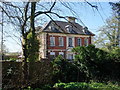
The Grange (Somers Sports & Social Club)
Formerly for staff of local forgemasters Walter Somers Ltd. The building was used by the Red Cross as an Auxiliary Hospital during the First World War.
Image: © John M
Taken: 8 Apr 2017
0.14 miles
3
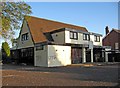
The former Woodman public house (1), Bromsgrove Road
The Woodman, a relatively modern pub on Bromsgrove Road (the A459), closed for business within the last year or so. It was for sale at one point, but as the estate agent's sign has gone, possibly a sale has been arranged. The pub sign, mounted on a post in the car park, has been covered over, and all other signage has been removed. As well as being known as The Woodman, the pub was at the time of closing also known by the strange name of Pull, or Pull@ The Woodman.
Image
Update - the building is now used as a convenience store.
Image: © P L Chadwick
Taken: 10 Oct 2010
0.15 miles
4
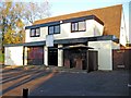
The former Woodman public house (2), Bromsgrove Road
The pub, recently called Pull or Pull@ The Woodman, seems to have had rather a chequered career in the last few years. The arrival of a new chef, and some favourable publicity in the local press in 2007, were apparently not sufficient to save it, as it closed sometime after August 2009. The pub is on the corner of Bromsgrove Road and Woodman Close.
Image
Update - the building is now used as a convenience store.
Image: © P L Chadwick
Taken: 10 Oct 2010
0.15 miles
6
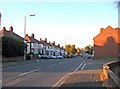
Bromsgrove Road (A459)
This part of Bromsgrove Road forms part of the A459 road. The houses on the left, with bow windows upstairs and downstairs, are of a design found all over the country, which was very popular in the 1930's. The road on the right is Woodman Close.
Image: © P L Chadwick
Taken: 10 Oct 2010
0.17 miles
7
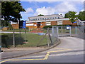
Manor Way School
The view of the Halesowen Primary School.
Image: © Gordon Griffiths
Taken: 28 May 2011
0.18 miles
8
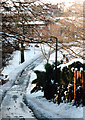
Halesowen Dogkennel Lane in the Snow 1990
Image: © Roy Hughes
Taken: 9 Dec 1990
0.20 miles
10
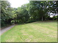
The end of the cut!
The trees in the centre and just left of centre are on the line of the Dudley No. 2 Canal and mark the end of an apparently filled in section that follows on from a very overgrown area that is still very obviously a 'cut'. This originally continued to Selly Oak but the loss of the long Lapal Tunnel saw it completely severed. Reinstatement is an ambition and the tunnel may be replaced with locks through Woodgate Valley.
Image: © Chris Allen
Taken: 27 Jul 2014
0.22 miles