1
Somers Forge, Halesowen
A well known heavy engineering site that was implicated in the Iraqi super-gun affair. This is a large site with two red brick chimneys.
Image: © Chris Allen
Taken: 27 Jul 2014
0.04 miles
2
Somers Forge, Halesowen
The view up the main approach to this world class forge and heavy engineering site. Capable of aerospace and nuclear industry standard work, it is best remembered for making parts of the infamous Iraqi super gun. The huge workshops dominate the traditional office building.
Image: © Chris Allen
Taken: 27 Jul 2014
0.08 miles
3
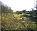
Halesowen Station (remains)
Viewed from Mucklow Hill, remains of Halesowen station.
Image: © Michael Westley
Taken: Unknown
0.08 miles
4
Somers Forge, Halesowen
Somers Forge, with Mucklow Hill in the background. This was taken from the top of a car park in town centre as it was the only place I could access to obtain a photograph at the same level as the forge.
Image: © billypicks
Taken: 8 Sep 2009
0.09 miles
5
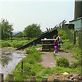
Dudley No. 2 Canal beyond limit of navigation, 1987
Looking over a deliberately collapsed bridge and through a chain-link fence at the remains, overgrown with sedge.
Image: © Robin Webster
Taken: 27 May 1987
0.09 miles
6
Halesowen Station (remains)
Site of former station on Old Hill to Longbridge railway line looking towards Mucklow Hill (in background).
http://www.railaroundbirmingham.co.uk/Stations/halesowen.php for further details.
Image: © Michael Westley
Taken: Unknown
0.10 miles
7
Dudley No. 2 Canal, Leasowes, Halesowen
This is where the canal ends against Mucklow Hill. The map fails to show an infilled 'dam' across the canal at Leasowes Park but I'm more or less stood on it. Behind me the canal along the embankment has had essential repairs carried out and is in water although divorced from the navigable section.
Image: © Chris Allen
Taken: 27 Jul 2014
0.11 miles
8
Limit of navigation, Dudley No. 2 Canal, 1987
A bridge was deliberately collapsed into the canal to prevent further navigation. This remains the limit for the foreseeable future. What looks vaguely like a piano is a duck house.
Image: © Robin Webster
Taken: 27 May 1987
0.11 miles
9
Dudley Canal Basin, Halesowen
View taken from the car park of the B&Q Warehouse, A458 Mucklow Hill, Halesowen.
Image: © Roy Hughes
Taken: 4 Feb 2009
0.12 miles
10
Forge House, Mucklow Hill, Halesowen
Image: © Chris Allen
Taken: 27 Jul 2014
0.12 miles


