1
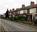
House on Finstall Road, Aston Fields, Bromsgrove
Image: © Jeff Gogarty
Taken: 14 Aug 2020
0.01 miles
2
Houses on Rigby Lane, Aston Fields
Seen from Finstall Road, which is parallel to Rigby Lane at this point but at a lower level.
Image: © Richard Vince
Taken: 1 Dec 2018
0.01 miles
3
Rigby Lane, Aston Fields
Climbing past the entrance to Rigby Hall School (right).
Image: © Richard Vince
Taken: 1 Dec 2018
0.04 miles
4
Road Bridge over the Lickey Incline
Image: © Sandy Gerrard
Taken: 19 Oct 2007
0.06 miles
5
Up the Lickey Incline, Bromsgrove
Viewed from St Godwald's Road bridge http://www.geograph.org.uk/photo/5214358 looking towards the Finstall Road bridge. Bromsgrove railway station is behind the camera. The gradient is 1 in 37.7 (2.65%) for 3.2 km (2 miles). Such a gradient is trifling for road vehicles, but is significant for a railway - the Lickey Incline is the steepest sustained mainline railway incline in Great Britain.
In the steam era, to assist trains up the incline, or in some cases to provide additional braking on the descent, particularly for freight trains without brakes on individual wagons, specialised banking engines were kept at Bromsgrove shed at the bottom of the incline.
Image: © Jaggery
Taken: 3 Dec 2016
0.06 miles
6
St. Godwalds - the parish church of Finstall, Bromsgrove.
Ironically, the church is actually in Aston Fields, not Finstall.
Image: © Mike Dodman
Taken: 11 Apr 2009
0.08 miles
7
Finstall Road houses, Bromsgrove
Northeast of the St Godwald's Road junction.
Image: © Jaggery
Taken: 3 Dec 2016
0.11 miles
8
House on Finstall Lane, Bromsgrove, Worcestershire
Close to the Rugby Club.
Image: © Jeff Gogarty
Taken: 20 Jan 2022
0.11 miles
9
Railway north of Bromsgrove Railway Station, Bromsgrove, Worcs
This is the start of the famous two mile 1 in 37 Lickey Bank or Lickey Incline, which in the days of steam engines used to tax the locomotives to their limits. A second locomotive would be used as a "banker". Even today some diesel locomotives, particularly with freight trains, need a second locomotive.
Image: © P L Chadwick
Taken: 1 Jan 2016
0.12 miles
10
New Trackbed at the Start o the Lickey Incline
Image: © Roy Hughes
Taken: 5 Nov 2016
0.13 miles


