IMAGES TAKEN NEAR TO
Station Road, BIRMINGHAM, B46 1DT

Introduction

This page details the photographs taken nearby to Station Road, B46 1DT by members of the Geograph project.

The Geograph project started in 2005 with the aim of publishing, organising and preserving representative images for every square kilometre of Great Britain, Ireland and the Isle of Man.

There are currently over 7.5m images from over14,400 individuals and you can help contribute to the project by visiting https://www.geograph.org.uk

Image Map


Images are licensed for reuse under creativecommons.org/licenses/by-sa/2.0
Notes
  • Clicking on the map will re-center to the selected point.
  • The higher the marker number, the further away the image location is from the centre of the postcode.

Image Listing (50 Images Found)

Images are licensed for reuse under creativecommons.org/licenses/by-sa/2.0
  • ...
Image
Details
Distance
1
An access road into Coleshill Industrial Estate
There are extensive industrial estates to the north of Coleshill.
Image: © Robin Stott Taken: 23 Jun 2016
0.02 miles
2
Industrial Estate by the railway
Image: © N Chadwick Taken: 17 Feb 2015
0.05 miles
3
The Norton Bar and Grill near Coleshill Parkway station
An older building that looks out of place, surrounded by modern industry and the fairly new station. The pub's garden is seen in Image
Image: © Robin Stott Taken: 23 Jun 2016
0.05 miles
4
Coleshill Parkway Station
This brand new station opened in August 2007 and does not yet appear on OS maps. It had barely been in operation for 3 months when this picture was taken with the DMU on the left heading towards Leicester. The chocolate and cream stock on the right is the Image
Image: © David Stowell Taken: 3 Nov 2007
0.05 miles
5
The Norton pub
As the photographer says in Image, this pub appears out of place surrounded by all the modernity. In reality, it's been here, in one form or another, since at least 1886 when the OS drew and published maps at a 1:2500 scale of the area, and quite possibly a lot longer. So, it could be argued that the pub belongs here, whilst all the modernity is actually out of place.
Image: © Richard Law Taken: 24 Nov 2016
0.06 miles
6
Bus shelter, Station Road near Coleshill Parkway station
The bus shelter is one of three or four on this south side of the station. While the station and the industrial estates in the area still look new, there are reminders of an earlier phase – patches of waste ground, an old building retained, and these massive concrete retaining walls.
Image: © Robin Stott Taken: 23 Jun 2016
0.06 miles
7
Industry by Coleshill Parkway Station
Image: © N Chadwick Taken: 17 Feb 2015
0.06 miles
8
Footpath junction ?
Marked on the map as footpaths they appear to have grown up over recent years. Never the less these roads do provide access to footpaths allowing exit from the industrial estate in a Northerly direction (left) and an easterly direction (right).
Image: © Mark Walton Taken: 6 Apr 2007
0.07 miles
9
Coleshill Parkway Station
Image: © N Chadwick Taken: 17 Feb 2015
0.07 miles
10
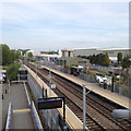
Looking east from Coleshill Parkway railway station
The station sits amid industrial estates with a sewage works not far away.
Image: © Robin Stott Taken: 15 May 2015
0.07 miles
  • ...