
IMAGES TAKEN NEAR TO
Rose Hill, BIRMINGHAM, B45 8RT
Introduction
This page details the photographs taken nearby to Rose Hill, B45 8RT by members of the Geograph project.
The Geograph project started in 2005 with the aim of publishing, organising and preserving representative images for every square kilometre of Great Britain, Ireland and the Isle of Man.

There are currently over 7.5m images from over14,400 individuals and you can help contribute to the project by visiting https://www.geograph.org.uk
Image Map
Images are licensed for reuse under creativecommons.org/licenses/by-sa/2.0
Notes
- Clicking on the map will re-center to the selected point.
- The higher the marker number, the further away the image location is from the centre of the postcode.
Image Listing (59 Images Found)
Images are licensed for reuse under creativecommons.org/licenses/by-sa/2.0
Image
Details
Distance
1

Thatched roof with a fox stalking ducks, located on properties on Rose Hill
Image: © Dillys Dad
Taken: 20 Dec 2025
0.00 miles

3

Sign for the Old Rose & Crown Hotel, Lickey
Image: © JThomas
Taken: 22 Jul 2017
0.03 miles

5

Exit from Old Rose & Crown and Lickey golf course
Image: © Roy Hughes
Taken: 24 Apr 2020
0.03 miles

7

Pond located next to The Old Rose and Crown
Image: © Dillys Dad
Taken: 7 Jan 2026
0.04 miles


10
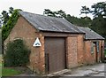
Old Buildings Opposite Old Barn, used by Lickey Golf Club Greenkeeping Staff
The image was taken under the Historic Buildings of Worcestershire Project run by Historic Environment & Archaeology Service of Worcestershire County Council. This project aims to provide a comprehensive record of all surviving historic buildings if it appeared on the 1st Edition Ordnance Survey of Worcestershire 1882-89 Image
Image: © Roy Hughes
Taken: 8 Apr 2009
0.04 miles