IMAGES TAKEN NEAR TO
Kingstanding Road, BIRMINGHAM, B44 9TH
Introduction
This page details the photographs taken nearby to Kingstanding Road, B44 9TH by members of the Geograph project.
The Geograph project started in 2005 with the aim of publishing, organising and preserving representative images for every square kilometre of Great Britain, Ireland and the Isle of Man.

There are currently over 7.5m images from over14,400 individuals and you can help contribute to the project by visiting https://www.geograph.org.uk
Image Map
Images are licensed for reuse under creativecommons.org/licenses/by-sa/2.0
Notes
- Clicking on the map will re-center to the selected point.
- The higher the marker number, the further away the image location is from the centre of the postcode.
Image Listing (29 Images Found)
Images are licensed for reuse under creativecommons.org/licenses/by-sa/2.0
Image
Details
Distance
5
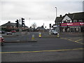
Over to Warren Farm Road - Kingstanding, North Birmingham
A view taken from Hawthorn Road to the south-east of its junction with the B4138 Kingstanding Road. This is looking eastwards into Warren Farm Road. This area shares its name with the hamlet of Kingstanding in Wychwood Forest, Oxfordshire. Time photo taken 1.59 pm GMT (Greenwich Mean Time).
Image: © Martin Richard Phelan
Taken: 1 Jan 2019
0.08 miles
6
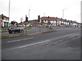
Three roads meeting - Kingstanding, North Birmingham
A view looking northwards on the dual carriageway of Kingstanding Road to its junction with Dyas Road and Hawthorn Road. Dyas Road is the road joining on the left. This area shares its name with the hamlet of Kingstanding in Wychwood Forest, Oxfordshire. Time photo taken 1.58 pm GMT (Greenwich Mean Time).
Image: © Martin Richard Phelan
Taken: 1 Jan 2019
0.09 miles
7
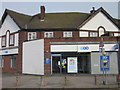
TSB Hawthorn Road - Kingstanding, North Birmingham
This is the Kingstanding branch of the TSB (Trustee Savings Bank) standing at the junction of Hawthorn Road and Warren Farm Road. There has been much in the press in recent weeks concerning the migration of the TSB computers from the previous Lloyds Bank system to one from its present owners Sabadell of Spain. The result was almost total meltdown, with customers not being able to access their accounts, accounts disappearing, customers seeing the account details of others and fraudsters stealing money from customers accounts. Experts from IBM (International Business Machines) have been drafted in to help sort things out. There may over the coming weeks be a Spanish inquisition of a different sort. In a way this has done us a favour in highlighting the dangers of a cashless society should the technology fail to work as it is supposed to. In time, though, stormy weather will fade and everything will be back on an even keel again. Time photo taken not available.
Image
Image: © Martin Richard Phelan
Taken: 29 May 2018
0.09 miles
8
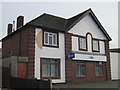
TSB another view - Kingstanding, North Birmingham
Another view of the TSB (Trustee Savings Bank) Kingstanding branch featured in TSB Kingstanding. Time photo taken not available.
Image
Image: © Martin Richard Phelan
Taken: 29 May 2018
0.09 miles
9
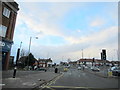
Hawthorne Road Kingstanding Approaching Kingstanding Road
Image: © Roy Hughes
Taken: 25 Dec 2017
0.10 miles