IMAGES TAKEN NEAR TO
Kingstanding Road, BIRMINGHAM, B44 8JS
Introduction
This page details the photographs taken nearby to Kingstanding Road, B44 8JS by members of the Geograph project.
The Geograph project started in 2005 with the aim of publishing, organising and preserving representative images for every square kilometre of Great Britain, Ireland and the Isle of Man.

There are currently over 7.5m images from over14,400 individuals and you can help contribute to the project by visiting https://www.geograph.org.uk
Image Map
Images are licensed for reuse under creativecommons.org/licenses/by-sa/2.0
Notes
- Clicking on the map will re-center to the selected point.
- The higher the marker number, the further away the image location is from the centre of the postcode.
Image Listing (11 Images Found)
Images are licensed for reuse under creativecommons.org/licenses/by-sa/2.0
Image
Details
Distance
1
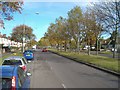
Kingstanding Road
View up Kingstanding Road from the College Road end.
Image: © Antony Dixon
Taken: 26 Oct 2011
0.07 miles
2
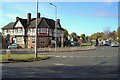
Golden Hind pub
. . . on the corner of Kingstanding Road and Greenholm Road
Image: © Antony Dixon
Taken: 26 Oct 2011
0.08 miles
3
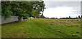
Burford Road Playing Fields
This 12.6 acre open space used to be playing fields but is now just grass. Access for local people is not easy as the main vehicle entrance (seen in this view) off Kingstanding Road is locked and the entire boundary is completely fenced, apart from one small pedestrian access gap. Three disused lighting columns are the only structures on the field; there is one tiny tree too. In autumn 2019, the city council is aiming to dispose of the land for development under Section 77 of the Schools Standards and Framework Act 1998. Public consultation is underway.
Image: © Paul Collins
Taken: 10 Oct 2019
0.11 miles
4
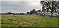
Burford Road Playing Fields
This 12.6 acre open space used to be playing fields but is now just grass. Access for local people is not easy as the main vehicle entrance (seen in this view) off Kingstanding Road is locked and the entire boundary is completely fenced, apart from one small pedestrian access gap. Three disused lighting columns are the only structures on the field; there is one tiny tree too. In autumn 2019, the city council is aiming to dispose of the land for development under Section 77 of the Schools Standards and Framework Act 1998. Public consultation is underway.
Image: © Paul Collins
Taken: 10 Oct 2019
0.12 miles
5
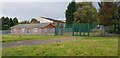
Burford Road Playing Fields Main Entrance
This 12.6 acre open space used to be playing fields but is now just grass. Access for local people is not easy as the main vehicle entrance (seen in this view) off Kingstanding Road is locked and the entire boundary is completely fenced, apart from one small pedestrian access gap. Three disused lighting columns are the only structures on the field; there is one tiny tree too.In autumn 2019, the city council is aiming to dispose of the land for development under Section 77 of the Schools Standards and Framework Act 1998. Public consultation is underway.
Image: © Paul Collins
Taken: 10 Oct 2019
0.16 miles
6
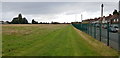
Burford Road Playing Fields
This 12.6 acre open space used to be playing fields but is now just grass. Access for local people is not convenient as the main vehicle entrance (seen in this view) off Kingstanding Road is locked and the entire boundary is completely fenced, apart from one small pedestrian access gap. Three disused lighting columns are the only structures on the field; there is one tiny tree too. In autumn 2019, the city council is aiming to dispose of the land for development under Section 77 of the Schools Standards and Framework Act 1998. Public consultation is underway.
Image: © Paul Collins
Taken: 10 Oct 2019
0.18 miles
7
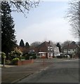
Kingstanding, Epwell Road Epwell Grove Junction
Image: © Roy Hughes
Taken: 30 Mar 2014
0.19 miles
8
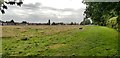
Burford Road Playing Fields
This view looks south. The three disused lighting columns are the only structures on the field; there is one tiny tree too. This 12.6 acre open space used to be playing fields but is now just grass. Access for local people is not easy as the main entrance off Kingstanding Road is locked and the entire boundary is completely fenced, apart from one small pedestrian access gap. In autumn 2019, the city council is aiming to dispose of the land for development under Section 77 of the Schools Standards and Framework Act 1998. Public consultation is underway.
Image: © Paul Collins
Taken: 10 Oct 2019
0.21 miles