
IMAGES TAKEN NEAR TO
Anstey Croft, BIRMINGHAM, B37 5LR
Introduction
This page details the photographs taken nearby to Anstey Croft, B37 5LR by members of the Geograph project.
The Geograph project started in 2005 with the aim of publishing, organising and preserving representative images for every square kilometre of Great Britain, Ireland and the Isle of Man.

There are currently over 7.5m images from over14,400 individuals and you can help contribute to the project by visiting https://www.geograph.org.uk
Image Map
Images are licensed for reuse under creativecommons.org/licenses/by-sa/2.0
Notes
- Clicking on the map will re-center to the selected point.
- The higher the marker number, the further away the image location is from the centre of the postcode.
Image Listing (7 Images Found)
Images are licensed for reuse under creativecommons.org/licenses/by-sa/2.0
Image
Details
Distance
1
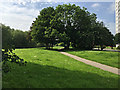
Footpath beside the River Cole and Forth Drive, Bacon?s End, east Birmingham
Overlooked by 14-storey Bangor House, right. Cook's Lane crosses the river, left of centre. The spacious layout of this estate has allowed many trees to develop their natural form and habit.
Image: © Robin Stott
Taken: 9 Jun 2018
0.10 miles
2
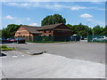
The Kingshurst Evangelical Church
This lies on Forth Drive, between Bacon's End and Kingshurst.
Image: © Richard Law
Taken: 13 Jun 2014
0.14 miles
3
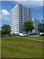
Keele House (left) and Bangor House (right)
Twin tower blocks in Bacon's End.
Image: © Richard Law
Taken: 13 Jun 2014
0.14 miles
4
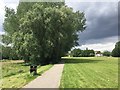
West through Babb's Mill Recreation Ground, Kingshurst, east Birmingham
In shadow, far left, is the River Cole. Behind the trees, right, is Fordbridge Road off which there is a free car park for the recreation ground, behind the camera. Seen between the trees is St Anthony's Catholic Primary School. The open space is also signed Babb's Mill Jubilee Park and Babb's Mill Local Nature Reserve. Poplars and willows planted for quick effect years ago are now in need of management.
Image: © Robin Stott
Taken: 15 Jun 2018
0.18 miles
5
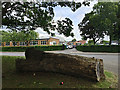
Entrance to staff car park, Endeavour House, Fordbridge Road, Kingshurst
Endeavour House is home to Solihull Community Housing http://www.solihullcommunityhousing.org.uk From maps it would appear that it was formerly a school. The view is from the entrance to Babbs Mill Park.
Image: © Robin Stott
Taken: 15 Jun 2018
0.22 miles
6
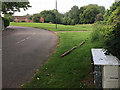
A bend on Conway Road, Bacon?s End, east Birmingham
This pleasant development near the River Cole (among the trees) doesn't always get the respect it deserves from some residents (or flytippers). Blocks of flats on Forth Drive, Keele House and Bangor House, can be seen over the trees Image
Image: © Robin Stott
Taken: 9 Jun 2018
0.24 miles
7

The River Cole in Babb's Mill Recreation Ground, Kingshurst, east Birmingham
The view downstream is from the footbridge that is reached from Fordbridge Road. There are footpaths on each side of the river. A riffle shows that the Cole is flowing away from the camera. There is a gravelly beach in the foreground. Downstream a glimpse of brown soil suggests recent erosion on the outside of a bend.
Image: © Robin Stott
Taken: 15 Jun 2018
0.24 miles