IMAGES TAKEN NEAR TO
Peak Croft, BIRMINGHAM, B36 8LA

Introduction

This page details the photographs taken nearby to Peak Croft, B36 8LA by members of the Geograph project.

The Geograph project started in 2005 with the aim of publishing, organising and preserving representative images for every square kilometre of Great Britain, Ireland and the Isle of Man.

There are currently over 7.5m images from over14,400 individuals and you can help contribute to the project by visiting https://www.geograph.org.uk

Image Map


Images are licensed for reuse under creativecommons.org/licenses/by-sa/2.0
Notes
  • Clicking on the map will re-center to the selected point.
  • The higher the marker number, the further away the image location is from the centre of the postcode.

Image Listing (16 Images Found)

Images are licensed for reuse under creativecommons.org/licenses/by-sa/2.0
Image
Details
Distance
1
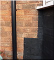
OS benchmark - Hodgehill, 93 Twycross Grove
An OS cutmark on the brickwork of one of the houses at the end of Twycross Grove; originally levelled at 111.8m above Ordnance Datum Newlyn.
Image: © Richard Law Taken: 22 Jan 2015
0.04 miles
2
Twycross Grove
Semis in a cul-de-sac on the northwest side of Hodgehill
Image: © Richard Law Taken: 22 Jan 2015
0.10 miles
3
Bromford Drive housing
View from hillside north of Collingbourne Avenue of housing on Bromford Drive. Between the blocks of flats can be seen Image]
Image: © Michael Westley Taken: 15 May 2010
0.11 miles
4
OS benchmark - Hodgehill, 23 Standlake Avenue
An OS cutmark on the west-facing wall of no 23 Standlake Ave; originally levelled at 112.04m above Ordnance Datum Newlyn.
Image: © Richard Law Taken: 22 Jan 2015
0.15 miles
5
Quite a view, Bromford
Plenty of space to create a park in - would provide a much needed boost to livelihood for people in a deprived part of Birmingham. View from wasteland to north of Collingbourne Avenue, looking down to blocks of flats on Bromford Drive
Image: © Michael Westley Taken: 15 May 2010
0.15 miles
6
Bromford Drive tower blocks
Image: © Peter Whatley Taken: 11 Feb 2012
0.16 miles
7
Bromford Drive Tower Blocks
Image: © N Chadwick Taken: 24 Jun 2012
0.16 miles
8
Tower blocks by Bromford Drive
Seen from M6 North passing Bromford. Power lines weave along this stretch of M6. The gantry is south of Fort Dunlop, formerly the Dunlop tyre factory, now a Travelodge hotel Image
Image: © Robin Stott Taken: 25 Sep 2010
0.17 miles
9
High Rise Buildings at Bromford
Viewed from M6. Flats are on Chipperfield Road Bromford
Image: © John Firth Taken: 13 Sep 2010
0.18 miles
10
Site of The Comet
The Comet pub once stood here; the benchmark on its east face has gone too.
Image: © Richard Law Taken: 22 Jan 2015
0.18 miles