1
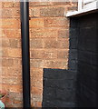
OS benchmark - Hodgehill, 23 Standlake Avenue
An OS cutmark on the west-facing wall of no 23 Standlake Ave; originally levelled at 112.04m above Ordnance Datum Newlyn.
Image: © Richard Law
Taken: 22 Jan 2015
0.05 miles
2
Twycross Grove
Semis in a cul-de-sac on the northwest side of Hodgehill
Image: © Richard Law
Taken: 22 Jan 2015
0.08 miles
3
Twycross Grove electrical substation
Apparently, no matter how high or spiky the fence around these places, the spray-can generation will find a way to get in there and make their mark. How classy.
Image: © Richard Law
Taken: 22 Jan 2015
0.09 miles
4
OS benchmark - Hodgehill, Twycross Grove substation
An OS cutmark on the south face of the electrical substation; originally levelled at 113.73m above Ordnance Datum Newlyn.
Image: © Richard Law
Taken: 22 Jan 2015
0.10 miles
5
OS benchmark - Hodgehill, 93 Twycross Grove
An OS cutmark on the brickwork of one of the houses at the end of Twycross Grove; originally levelled at 111.8m above Ordnance Datum Newlyn.
Image: © Richard Law
Taken: 22 Jan 2015
0.12 miles
6
Collingbourne Avenue, Hodgehill
A residential street between Bromford Road and Chipperfield Road. Mostly 1950s semis, there's also a small parade of shops a little further on, although The Comet pub just beyond the far end of this picture has been demolished.
Image: © Richard Law
Taken: 22 Jan 2015
0.13 miles
7
OS benchmark - Hodgehill, 315 Bromford Road
An OS cutmark on the front wall of 315 Bromford Road; originally levelled at 109.97m above Ordnance Datum Newlyn.
Image: © Richard Law
Taken: 22 Jan 2015
0.13 miles
8
Site of The Comet
The Comet pub once stood here; the benchmark on its east face has gone too.
Image: © Richard Law
Taken: 22 Jan 2015
0.17 miles
9
Electricity sub station, Hodge Hill College
Image: © Alex McGregor
Taken: 15 Jan 2015
0.19 miles
10
Bromford Drive housing
View from hillside north of Collingbourne Avenue of housing on Bromford Drive. Between the blocks of flats can be seen
Image]
Image: © Michael Westley
Taken: 15 May 2010
0.20 miles


