IMAGES TAKEN NEAR TO
Sambourne Drive, BIRMINGHAM, B34 7JF
Introduction
This page details the photographs taken nearby to Sambourne Drive, B34 7JF by members of the Geograph project.
The Geograph project started in 2005 with the aim of publishing, organising and preserving representative images for every square kilometre of Great Britain, Ireland and the Isle of Man.

There are currently over 7.5m images from over14,400 individuals and you can help contribute to the project by visiting https://www.geograph.org.uk
Image Map
Images are licensed for reuse under creativecommons.org/licenses/by-sa/2.0
Notes
- Clicking on the map will re-center to the selected point.
- The higher the marker number, the further away the image location is from the centre of the postcode.
Image Listing (24 Images Found)
Images are licensed for reuse under creativecommons.org/licenses/by-sa/2.0
Image
Details
Distance
1
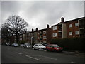
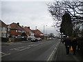
Low rise flats on Hurst Lane, Shard End
Image: © Richard Vince
Taken: 10 Mar 2018
0.13 miles
2
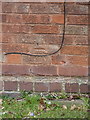
OS benchmark - Kingshurst, Flat 41 Hurst Lane
An OS cutmark on a block of flats on the west side of Hurst Lane; originally levelled in 1965 at 100.54m above Ordnance Datum Newlyn.
Image: © Richard Law
Taken: 20 Feb 2015
0.13 miles
3
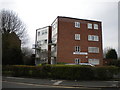
Castle Court, Shard End
On Hurst Lane a little way south of Chester Road.
Image: © Richard Vince
Taken: 10 Mar 2018
0.14 miles
4
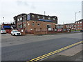
The Crown at Shard End
A large pub on the corner of Chester Road and Hurst Lane.
Image: © Richard Law
Taken: 20 Feb 2015
0.14 miles
6
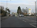
North end of Hurst Lane, Shard End
Looking towards Chester Road.
Image: © Richard Vince
Taken: 10 Mar 2018
0.15 miles
7
The Crown, Hurst Lane, Castle Bromwich, Birmingham
Image: © Ann Causer
Taken: 23 Aug 2014
0.16 miles
9
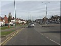
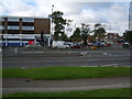
Chester Road (B4114) east of the junction with Bradford Road
Image: © Peter Whatley
Taken: 16 Feb 2013
0.16 miles
10
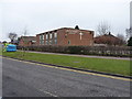
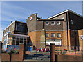
Shard End Baptist Church
Located on Timberley Lane, between the main Chester Road and Brownfield Road.
Image: © Richard Law
Taken: 20 Feb 2015
0.18 miles