
IMAGES TAKEN NEAR TO
Mill View, BIRMINGHAM, B33 9TR
Introduction
This page details the photographs taken nearby to Mill View, B33 9TR by members of the Geograph project.
The Geograph project started in 2005 with the aim of publishing, organising and preserving representative images for every square kilometre of Great Britain, Ireland and the Isle of Man.

There are currently over 7.5m images from over14,400 individuals and you can help contribute to the project by visiting https://www.geograph.org.uk
Image Map
Images are licensed for reuse under creativecommons.org/licenses/by-sa/2.0
Notes
- Clicking on the map will re-center to the selected point.
- The higher the marker number, the further away the image location is from the centre of the postcode.
Image Listing (13 Images Found)
Images are licensed for reuse under creativecommons.org/licenses/by-sa/2.0
Image
Details
Distance
1
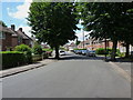
Fordfield Road, Kitts Green
An offshoot of Wychbld Crescent, which joins up to the west with Lea Ford Road.
Image: © Richard Law
Taken: 29 Jul 2014
0.05 miles
2
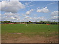
Playing fields, Kitts Green
The playing fields beside Lea Ford Road.
Image: © David Stowell
Taken: 19 Sep 2006
0.06 miles
3
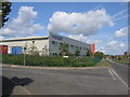
Modern Factory, Kitts Green
Modern buildings in Lea Ford Road.
Image: © David Stowell
Taken: 19 Sep 2006
0.11 miles
4
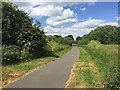
Shared path in Kingfisher Country Park near Shard End, east Birmingham
For cyclists the path keeps to level ground, never far from the River Cole. Two stands of hemlock (Conium maculatum) frame the view ahead.
Image: © Robin Stott
Taken: 21 Jun 2018
0.13 miles
5
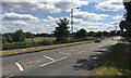
South on Lea Ford Road, towards Kitts Green, northeast Birmingham
Just south of the bridge over the River Cole, seen winding its way east on the left. The expanse of grassland is presumably floodplain. The industrial elements on the right are but a glimpse of an extensive plant in Image: Image and Image
Image: © Robin Stott
Taken: 21 Jun 2018
0.14 miles
6
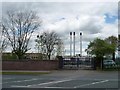
Factory chimneys, east side of Kitt's Green Road
Alcoa make aluminium sheet and plate for the aerospace industry here.
Image: © Christine Johnstone
Taken: 16 May 2012
0.17 miles
7
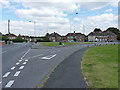
Triangular road junction in Kitts Green
Lea Village joins Lea Ford Road in the middle of the Kitts Green housing estate.
Image: © Richard Law
Taken: 29 Jul 2014
0.19 miles
8
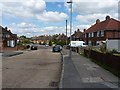
Wychbold Crescent, Kitts Green
1950s housing on the northern side of Kitts Green.
Image: © Richard Law
Taken: 29 Jul 2014
0.22 miles
9
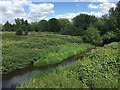
River Cole near Colehall, east Birmingham
The River Cole runs through Birmingham's eastern and southeastern suburbs. The floodplain doubles as extensive public open space. Here the flood-prone area is left to nature while, beyond the trees, the ground rises to playing fields and informal open space. The view is from the bridge at the meeting of Packington Avenue and Lea Ford Road.
Image: © Robin Stott
Taken: 21 Jun 2018
0.22 miles
10
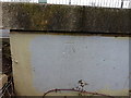
OS benchmark - Colehall, Lea Ford bridge
An OS cutmark on the concrete parapet of the bridge at Lea Ford; originally levelled at 92.39m above Ordnance Datum Newlyn
Image: © Richard Law
Taken: 20 Feb 2015
0.23 miles