1
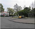
Bell Lane scene
Image: © Peter Whatley
Taken: 16 Feb 2013
0.10 miles
2
OS benchmark - Marston Green, The Radleys railway bridge
An OS cutmark in the brick buttress of the bridge carrying the West Coast Main Line over The Radleys; originally levelled at 89.57m above Ordnance Datum Newlyn.
Image: © Richard Law
Taken: 16 Jan 2014
0.11 miles
3
Railway bridge over The Radleys
Carrying The West Coast main line.
Image: © Steve Fareham
Taken: 18 May 2012
0.11 miles
4
The Radleys railway bridge
The West Coast Main Line between Birmingham International and New Street crosses The Radleys at this substantial bridge. It's too narrow for two cars to pass, so a give-way system is operated.
Image: © Richard Law
Taken: 16 Jan 2014
0.11 miles
5
Wildflower meadow by Tile Cross Road
Looking towards the bus terminus, where a bus can be seen, and the buildings at the junction of Tile Cross Road with St. Giles Road and Bell Lane. The wildflowers have been planted at the edge of a small park between St. Giles Road and Mackadown Lane. The flowers appear to be mainly corn marigolds (yellow) with some corn chamomile (white petals) and cornflower (blue); there were also some poppies also (not visible in the photo) - a typical 'cornfield wildflower' seed packet mixture.
Image: © A J Paxton
Taken: 27 Aug 2014
0.15 miles
6
OS benchmark - Tile Cross, 81 Bell Lane
An OS cutmark at the side of no 81 Bell Lane; originally levelled in 1965 at 88.771m above Ordnance Datum Newlyn.
Image: © Richard Law
Taken: 6 May 2014
0.15 miles
7
Bell Lane turning circle, Tile Cross
Situated on Tile Cross Road just west of Bell Lane, this turning circle is rather quieter than it once was. Originally the terminus of route 14 from Birmingham city centre via Stechford, since that service was extended to Chelmsley Wood a few years ago, only route 17 (from the city centre via Hob Moor Road and Garretts Green) uses it. One of National Express West Midlands' Scania OmniLink buses can be glimpsed through the trees.
Image: © Richard Vince
Taken: 8 Dec 2012
0.16 miles
8
OS benchmark - Marston Green, no 66 Tile Cross Road
An OS cutmark on the front of no 66 Tile Cross Road; originally levelled in 1965 at 96.348m above Ordnance Datum Newlyn.
Image: © Richard Law
Taken: 6 May 2014
0.17 miles
9
Tributary of the Hatchford Brook
A rather overgrown & neglected waterway, which drains out of housing at Lyndon Green, joins the Hatchford Brook just downstream of here, and then runs past Marston Green to join the River Cole.
Image: © Richard Law
Taken: 16 Jan 2014
0.17 miles
10
The junction of The Radleys with Bell Lane
Image: © Steve Fareham
Taken: 18 May 2012
0.18 miles


