IMAGES TAKEN NEAR TO
The Walmers Walk, BIRMINGHAM, B31 2UG
Introduction
This page details the photographs taken nearby to The Walmers Walk, B31 2UG by members of the Geograph project.
The Geograph project started in 2005 with the aim of publishing, organising and preserving representative images for every square kilometre of Great Britain, Ireland and the Isle of Man.

There are currently over 7.5m images from over14,400 individuals and you can help contribute to the project by visiting https://www.geograph.org.uk
Image Map
Images are licensed for reuse under creativecommons.org/licenses/by-sa/2.0
Notes
- Clicking on the map will re-center to the selected point.
- The higher the marker number, the further away the image location is from the centre of the postcode.
Image Listing (22 Images Found)
Images are licensed for reuse under creativecommons.org/licenses/by-sa/2.0
Image
Details
Distance
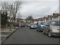
2
Southern end of Farren Road, Longbridge
Image: © Peter Whatley
Taken: 10 Mar 2012
0.13 miles
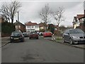
3
Farren Road, Longbridge
A residential road that leads off the Bristol Road
Image: © David Smith
Taken: 21 May 2013
0.15 miles
4
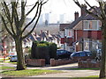
Looking across corner of Tessall Lane
The high rise blocks are off Central Avenue on Shifnal Walk.
They are called Risborough House, Manderville House and Wendover House.
They are right next to some of the prefabs in Austin Village. Image
Image: © Jeff Gogarty
Taken: 14 Mar 2016
0.17 miles
5
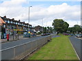
Bristol Road South, Longbridge
Looking into towards Northfield along the central reservation of the Bristol Road at the junction with Tessall Lane. From 1923 to 5th July 1952 this wide central reservation carried the Birmingham trams out to Rednal and Rubery. There are aspirations to right the shortsighted 1950s closure and extend the Midlands Metro along this route.
Image: © David Stowell
Taken: 26 May 2006
0.17 miles
6
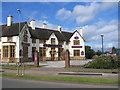
King George V, Bristol Road South, Longbridge
A grand estate style pub, now decorated as an oriental restaurant, at the junction with Tessall Lane.
Image: © David Stowell
Taken: 26 May 2006
0.17 miles
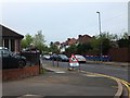
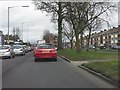
7
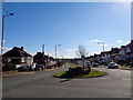
Tessall Lane, Northfield towards the A38
Taken from the roundabout at the junction of Tessall Lane and Hanging Lane
Image: © Jeff Gogarty
Taken: 7 Mar 2016
0.18 miles
8

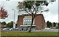
Everlast Fitness Club, Longbridge
Formerly the Sports Direct club Image, and a cinema before that
Image: © David Smith
Taken: 23 Oct 2019
0.18 miles
10
Queued traffic on Bristol Road South
Image: © Peter Whatley
Taken: 10 Mar 2012
0.20 miles