
IMAGES TAKEN NEAR TO
Alwold Road, BIRMINGHAM, B29 5RT
Introduction
This page details the photographs taken nearby to Alwold Road, B29 5RT by members of the Geograph project.
The Geograph project started in 2005 with the aim of publishing, organising and preserving representative images for every square kilometre of Great Britain, Ireland and the Isle of Man.

There are currently over 7.5m images from over14,400 individuals and you can help contribute to the project by visiting https://www.geograph.org.uk
Image Map
Images are licensed for reuse under creativecommons.org/licenses/by-sa/2.0
Notes
- Clicking on the map will re-center to the selected point.
- The higher the marker number, the further away the image location is from the centre of the postcode.
Image Listing (9 Images Found)
Images are licensed for reuse under creativecommons.org/licenses/by-sa/2.0
Image
Details
Distance
3
Shenley Lane north of Senneleys Park Road
Image: © Peter Whatley
Taken: 10 Mar 2012
0.18 miles
5
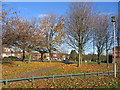
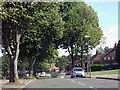
Sunny California
These trees beside California Way, in the south of this square have now all but lost their leaves for the winter but still lend a splash of colour with the low angle of the sun.
Image: © David Stowell
Taken: 11 Dec 2005
0.22 miles
6
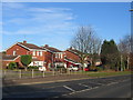
California Way
Some of the modern housing development adjacent to California Way.
Image: © David Stowell
Taken: 11 Dec 2005
0.22 miles
7
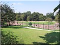
Weoley Castle ruins
The castle, which dates from the 13th-15th centuries, was a fortified manor house owned by, among others, the barons of Dudley. The ruins are in disrepair (!) and closed to the public. The closest you can get is the two information boards visible in the photo, and even that area is closed on weekdays.
Information: http://www.schoolsliaison.org.uk/weoleycastle/weoleycastle.htm
Image: © Adrian Bailey
Taken: 17 Aug 2005
0.23 miles
8
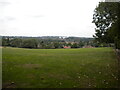
Playing fields off Weoley Castle Road, Weoley Castle
With a view across west Birmingham towards Warley.
Image: © Richard Vince
Taken: 3 Sep 2022
0.24 miles
9
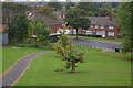
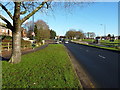
Alwold Road, Weoley Castle
Alwold Road is named after a Saxon Chieftain who held land in this area. No doubt, in conferring this name, Birmingham Corporation was mindful of the medieval association with Weoley Castle, the remains of which lie just north of the road. The 'castle' was in fact a fortified manor house and the way land rises immediately to the south is an indication that this was not intended to be a truly defensive location. Land surrounding the castle was purchased by the Corporation in the 1930s for housing, built in the 'garden city' style very fashionable at the time.
Image: © Stephen McKay
Taken: 3 Oct 2015
0.25 miles