
IMAGES TAKEN NEAR TO
St. Peters Close, BIRMINGHAM, B28 0EF
Introduction
This page details the photographs taken nearby to St. Peters Close, B28 0EF by members of the Geograph project.
The Geograph project started in 2005 with the aim of publishing, organising and preserving representative images for every square kilometre of Great Britain, Ireland and the Isle of Man.

There are currently over 7.5m images from over14,400 individuals and you can help contribute to the project by visiting https://www.geograph.org.uk
Image Map
Images are licensed for reuse under creativecommons.org/licenses/by-sa/2.0
Notes
- Clicking on the map will re-center to the selected point.
- The higher the marker number, the further away the image location is from the centre of the postcode.
Image Listing (25 Images Found)
Images are licensed for reuse under creativecommons.org/licenses/by-sa/2.0
Image
Details
Distance
1
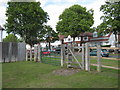
Cole Valley Road, Billesley
Pedestrian access to grass area and river Cole walks from Cole Valley Road
Image: © Michael Westley
Taken: 13 Jun 2011
0.10 miles
2
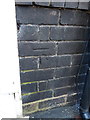
OS benchmark - Yardley Wood, 120 Cole Valley Road
An OS cutmark on the wall of no 120; originally levelled, probably in 1965, at 126.32m above Ordnance Datum Newlyn.
Image: © Richard Law
Taken: 18 Apr 2018
0.10 miles
3
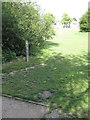
7 Wonders Walk, Cole Valley
Start of trail beside River Cole, between Yardley Wood and Hall Green. Ahead, the houses on Cole Valley Road can be seen.
Image: © Michael Westley
Taken: 13 Jun 2011
0.14 miles
4
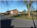
Development site on Cole Valley Road
Google Streetview dated 2012 suggests this site has been a potential building plot for at least 6 years, and was a very overgrown plot prior to that. The house on the left of the photo has been built since the most recent imagery available through Streetview, and replaces a white-painted single detached property which had a tall brick chimney.
Image: © Richard Law
Taken: 18 Apr 2018
0.14 miles
5
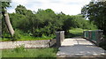
Cole Valley trail
Surfaced footpath / cycle bridge across River Cole near Cole Valley Road
Image: © Michael Westley
Taken: 13 Jun 2011
0.15 miles
6
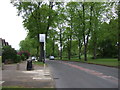
Bus stop on Robin Hood Lane (A4040)
Looking north west.
Image: © JThomas
Taken: 6 May 2017
0.15 miles
7
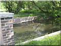
River Cole, Billesley
Small weir on river, close to footbridge and cycleway
Image: © Michael Westley
Taken: 13 Jun 2011
0.16 miles
8
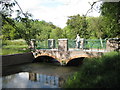
Cole Valley footbridge
Picturesque view of river Cole, and bridge approached from Cole Valley Road
Image: © Michael Westley
Taken: 13 Jun 2011
0.16 miles
9

Robin Hood Lane Rail Bridge
The Railway Bridge at the end of Robin Hood Lane, near the junction of Webb Lane, Hall Green, Birmingham.
Image: © Simon Dean
Taken: 4 Jun 2007
0.17 miles
10
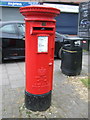
Elizabeth II postbox on Cole Valley Road
Postbox No. B28 1145.
See Image] for context.
Image: © JThomas
Taken: 6 May 2017
0.18 miles