IMAGES TAKEN NEAR TO
Gospel Lane, BIRMINGHAM, B27 7AG
Introduction
This page details the photographs taken nearby to Gospel Lane, B27 7AG by members of the Geograph project.
The Geograph project started in 2005 with the aim of publishing, organising and preserving representative images for every square kilometre of Great Britain, Ireland and the Isle of Man.

There are currently over 7.5m images from over14,400 individuals and you can help contribute to the project by visiting https://www.geograph.org.uk
Image Map
Images are licensed for reuse under creativecommons.org/licenses/by-sa/2.0
Notes
- Clicking on the map will re-center to the selected point.
- The higher the marker number, the further away the image location is from the centre of the postcode.
Image Listing (7 Images Found)
Images are licensed for reuse under creativecommons.org/licenses/by-sa/2.0
Image
Details
Distance
1
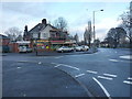
Shops at the mini roundabout
At the junction of Gospel Lane with Severne Road.
Image: © Richard Law
Taken: 13 Dec 2016
0.09 miles
2
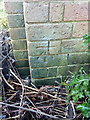
OS benchmark - Olton, 2 Severne Road
An OS cutmark on the wall of a (currently semi-derelict) house at 2 Severne Road; originally levelled at 117.77m above Ordnance Datum Newlyn.
Image: © Richard Law
Taken: 13 Dec 2016
0.09 miles
3
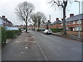
Along Severne Road
1950s housing in the Olton area.
Image: © Richard Law
Taken: 13 Dec 2016
0.15 miles
4
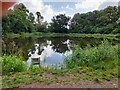
The Round Pool, Fox Hollies Park/Pool Farm Park
Formerly associated with Pool Farm. Pool drains via an overflow into the nearby Westley Brook, which lies lower.
Image: © geoffrey
Taken: 10 Jul 2023
0.17 miles
5
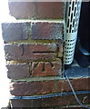
OS benchmark - Olton, 65 Severne Road
An OS cutmark on the side wall of no 65 Severne Road; originally levelled at 119.17m above Ordnance Datum Newlyn.
Image: © Richard Law
Taken: 13 Dec 2016
0.19 miles
6
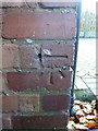
OS benchmark - Olton, 310 Gospel Lane
An OS cutmark on the north wall of 310 Gospel Lane; originally levelled at 118.415m above Ordnance Datum Newlyn.
Image: © Richard Law
Taken: 13 Dec 2016
0.22 miles