IMAGES TAKEN NEAR TO
Coventry Road, BIRMINGHAM, B26 3PY
Introduction
This page details the photographs taken nearby to Coventry Road, B26 3PY by members of the Geograph project.
The Geograph project started in 2005 with the aim of publishing, organising and preserving representative images for every square kilometre of Great Britain, Ireland and the Isle of Man.

There are currently over 7.5m images from over14,400 individuals and you can help contribute to the project by visiting https://www.geograph.org.uk
Image Map
Images are licensed for reuse under creativecommons.org/licenses/by-sa/2.0
Notes
- Clicking on the map will re-center to the selected point.
- The higher the marker number, the further away the image location is from the centre of the postcode.
Image Listing (16 Images Found)
Images are licensed for reuse under creativecommons.org/licenses/by-sa/2.0
Image
Details
Distance
1
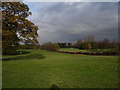
Hatchford Brook Golf Course
The golf course itself occupies most of the land in SP1684 immediately adjacent to Birmingham International Airport, although the Club House and Golf Centre is located in SP1683 from where this picture was taken.
Image: © peter lloyd
Taken: 28 Nov 2005
0.07 miles
2
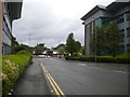
Hatchford Way, Sheldon
Providing vehicular access to Eagle Court Business Park, off Coventry Road just inside Birmingham's city boundary.
Image: © Richard Vince
Taken: 8 Jun 2019
0.08 miles
3
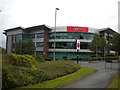
Virgin Media offices, Sheldon
In Eagle Court Business Park, off Coventry Road just inside Birmingham's city boundary.
Image: © Richard Vince
Taken: 8 Jun 2019
0.09 miles
4
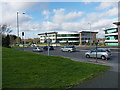
Eagle Court Business Park
One of several sets of commercial premises along the A45 Coventry Road; this one leads through to the Hatchford Brook Golf Centre.
Image: © Richard Law
Taken: 24 Feb 2014
0.11 miles
6

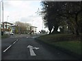
Hatchford Brook golf course
The course (and associated leisure centre) is operated by a charity called Mytime Active, in partnership with the Birmingham City Council.
Image: © Richard Law
Taken: 24 Feb 2014
0.17 miles
7
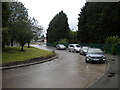
Former Arden Oak bus turning circle, Sheldon (2)
On Coventry Road just east of the Arden Oak pub (now a Harvester). Buses ceased to terminate here regularly in the 1990s, but the turning circle now provides a means for eastbound traffic to U turn to join the westbound carriageway of Coventry Road. This facility was being used by bus route A10 at the time I visited, so it has not been entirely abandoned by buses. It also contained a small group of private hire vehicles parked up between jobs.
Image: © Richard Vince
Taken: 8 Jun 2019
0.18 miles
8
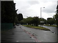
Former Arden Oak bus turning circle, Sheldon (1)
On Coventry Road just east of the Arden Oak pub (now a Harvester). Buses ceased to terminate here regularly in the 1990s, but the turning circle now provides a means for eastbound traffic to U turn to join the westbound carriageway of Coventry Road. This facility was being used by bus route A10 at the time I visited, so it has not been entirely abandoned by buses. It also contained a small group of private hire vehicles parked up between jobs.
Image: © Richard Vince
Taken: 8 Jun 2019
0.19 miles